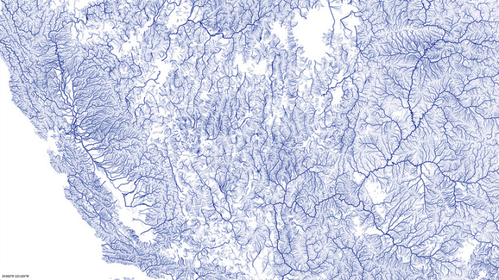
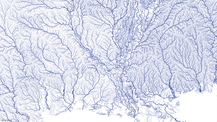
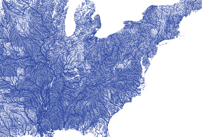
Beginning as an exercise in using open source information rather than to be a piece of art, Nelson Minar's All Rivers map is a detailed representation of every waterway in the bordering 48 United States. By using the National Hydrography Dataset, Minar outlined each river, stream, and creek he could find and related their Strahler number, which is a measure of their significance, onto the vector map he created. This interactive chart allows users to explore the different regions and examine the variety and types of waterways found in the area.
The unexpected result from this is a beautiful networking of blue veins across the country that shows even the most supposedly baron areas have many little waterways running throughout the land. It's both an informative and aesthetically pleasing collection of data.