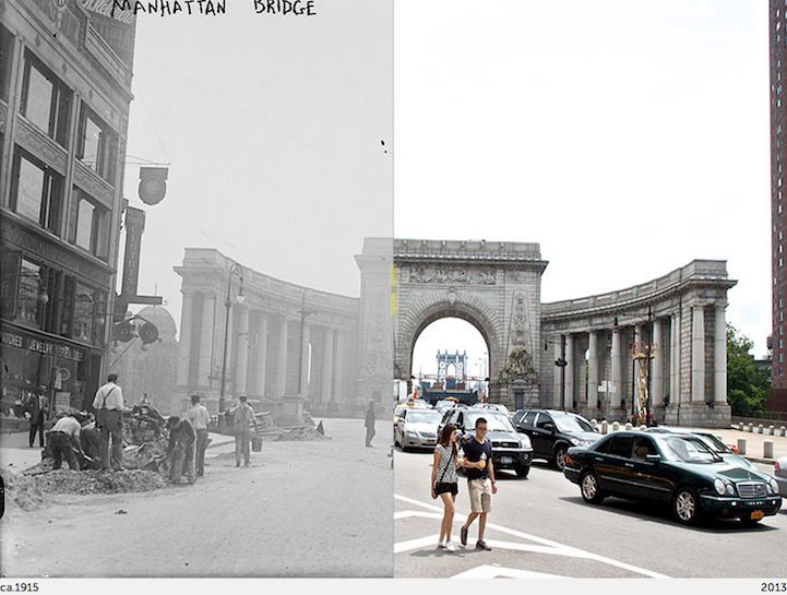
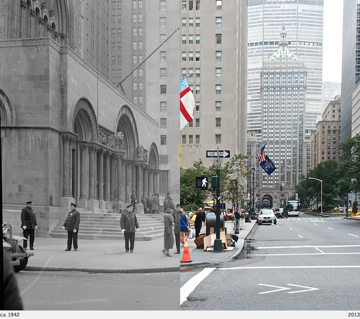
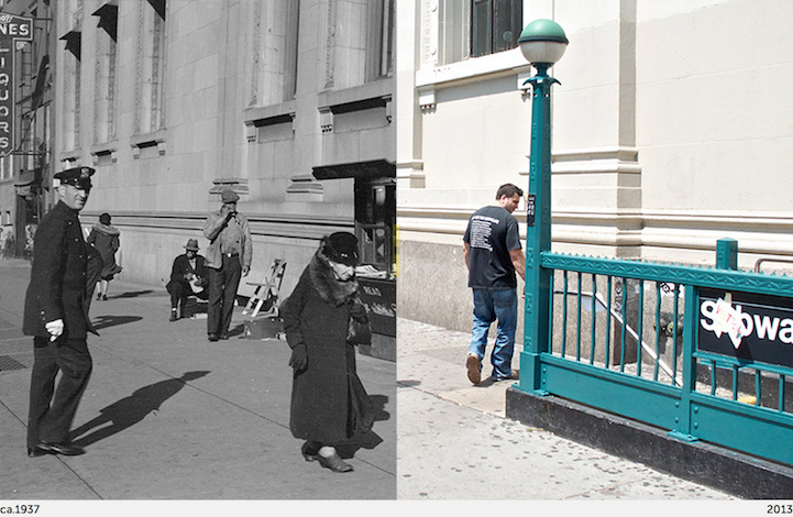
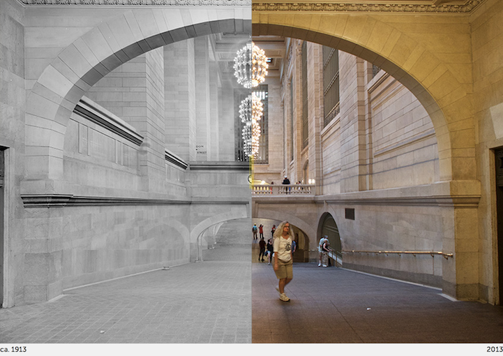
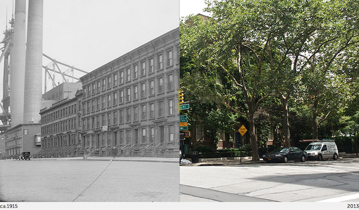
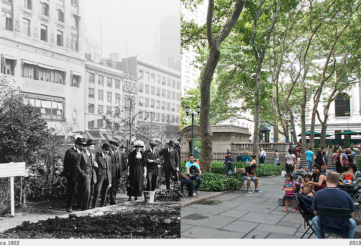
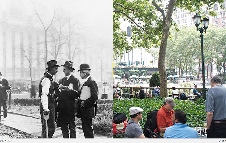
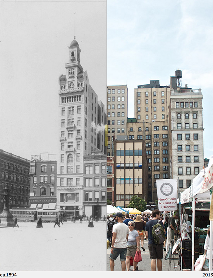
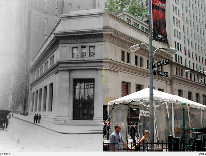
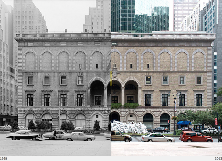
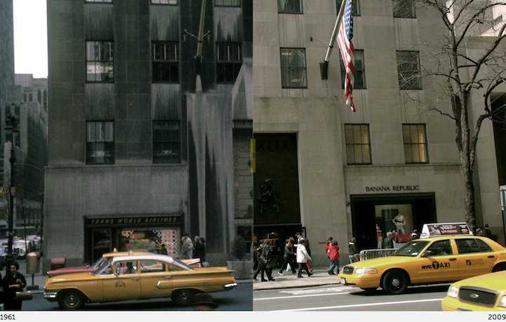
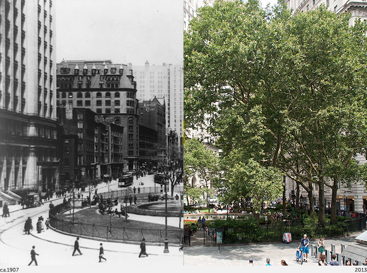
New York City is constantly evolving and growing, making it difficult to document every change that has occurred, but NYC Grid is taking a stab at it. Run by Paul Sahner the ambitious website seeks to map the entire city “street by street and block by block” through photos. In addition to simply capturing present-day neighborhoods, though, the site also gives a peek of what specific areas looked like in the past, comparing the two in its “Before & After” section.
Each location examined in this catalog presents a side-by-side look at one perspective of the designated place, revealing the differences and similarities over decades and even a century. With a moveable, dividing slider going straight down the middle, visitors are given the opportunity to shift between the past and present. This interactive element reveals changes across time with great ease. As one shifts the slider back and forth, streetlights, modern cars, public art installations, and new buildings vanish and reappear.
Be sure to compare New York City's past and present with the interactive slider on NYC Grid's website.
NYC Grid website
via [PetaPixel]