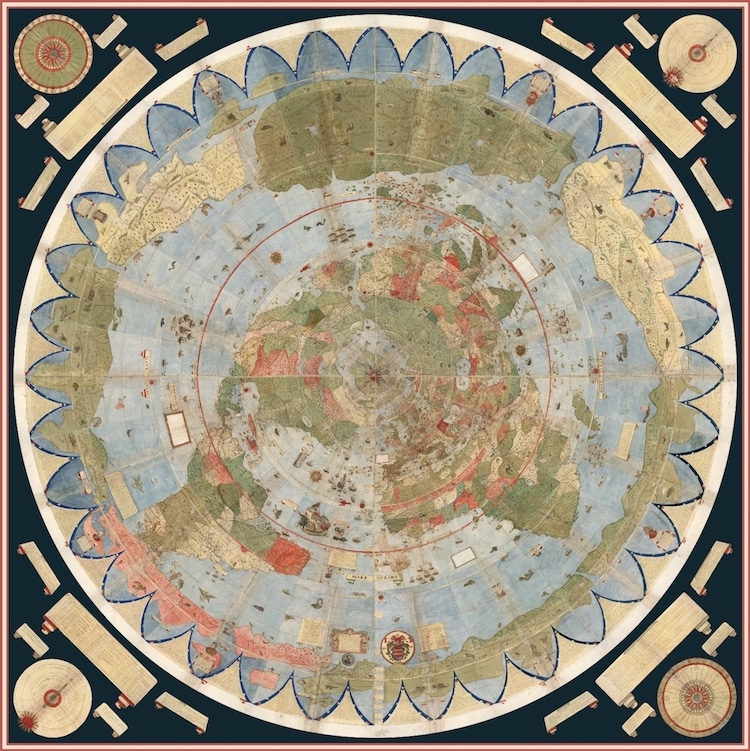
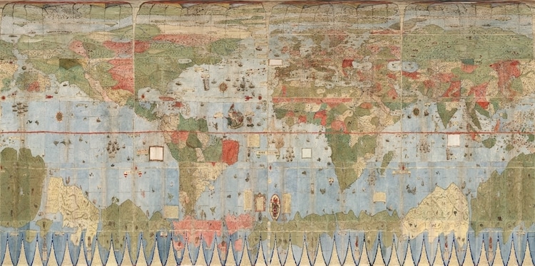
Finished composite map
Cartography expert David Rumsey, together with his nephew, painstakingly joined together one of the world's largest maps for the first time. For over 400 years, Urbano Monte's color world map was spread out over 60 individual pages. Created just 95 years after the discovery of America, the 1587 rendering is one of the earliest world maps; and when placed together, it stretches out a little over 10 feet.
By digitally joining together Monte's hand-drawn sheets, it's even easier to appreciate the incredible details of the historical map. “Monte's map reminds us of why historical maps are so important as primary resources: the north polar azimuthal projection of his planisphere uses the advanced scientific ideas of his time; the artistry in drawing and decorating the map embodies design at the highest level,” writes Rumsey. “And the view of the world then gives us a deep historical resource with the listing of places, the shape of spaces, and the commentary interwoven into the map. Science, art, and history all in one document.
Not limited to just geographical information, Monte's map also shows data about climate, changes to the amount of daylight, and distances within regions. And in a DIY twist, he also included detailed instructions about how the folios could be pasted onto a wood board and rotated on an axis through the North Pole.
A detailed look at the map shows how Monte explored the flora, fauna, and even architecture of each country with surprising accuracy. Camels and lions dot central Africa while exotic birds have a home in South America. These are mingled with some of the fantastical creatures that often show up on early maps—centaurs, griffons, and the sea god Triton all swirling around the seas or dashing on land.
After joining the 60 sheets into a 10-foot planisphere, it was then placed into Mercator projection. “We immediately understand why he used the north polar projection instead of Mercator’s: Monte wanted to show the entire earth as close as possible to a three-dimensional sphere using a two-dimensional surface,” Rumsey observes. “His projection does just that, notwithstanding the distortions around the south pole. Those same distortions exist in the Mercator’s world map, and by their outsized prominence on Monte’s map they gave him a vast area to indulge in all the speculations about Antarctica that proliferated in geographical descriptions in the 16th century.”
In fact, Rumsey points out how pleased Monte would have been to see that his preferred polar projection has not come back into fashion, with a modern version of his map used as the UN emblem. The Urbano Monte map, of which only one other copy exists, is now part of the David Rumsey Map Collection at Stanford University.
Urbano Monte's historical world map was hand drawn across 60 individual sheets in 1587.
Northern Europe
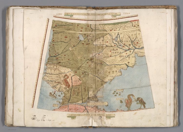
Southern Argentina and Southern Chile
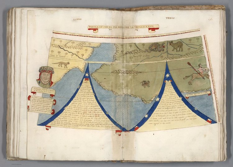
Antarctica and Portrait of Montezuma
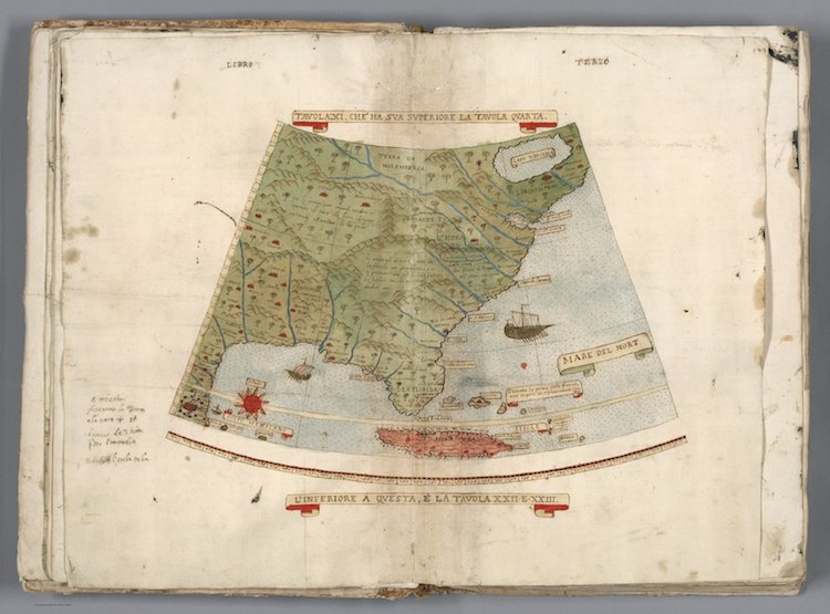
Eastern United States and Cuba
Cartography expert David Rumsey, who owns one of two copies of the Monte map, recently scanned and digitally stitched together the work. It is one of the largest early maps, which stretches over 10 feet.
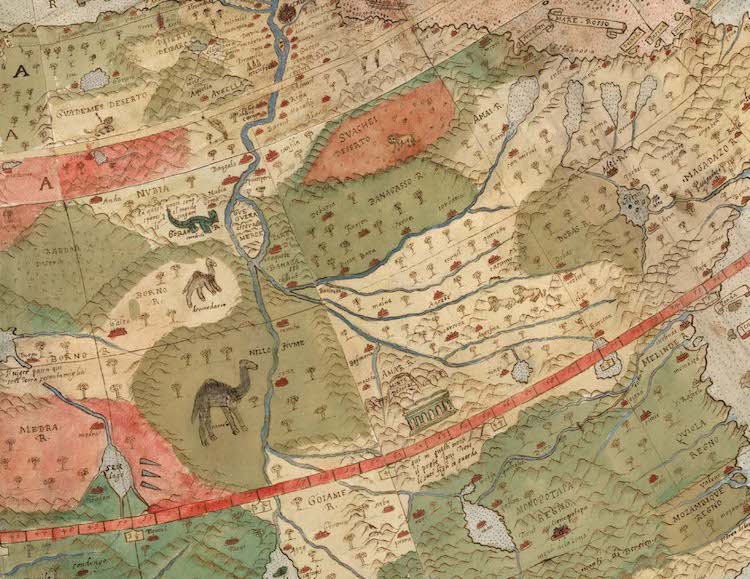
Detail showing the joining of two sheets of the map depicting central Africa.

Portrait of King Philip II of Spain off the coast of Brazil

Japan
The map is full of artistic detail, from fantastical creatures to two self-portraits of the author.

Detail of South America, Venezuela, Guyana
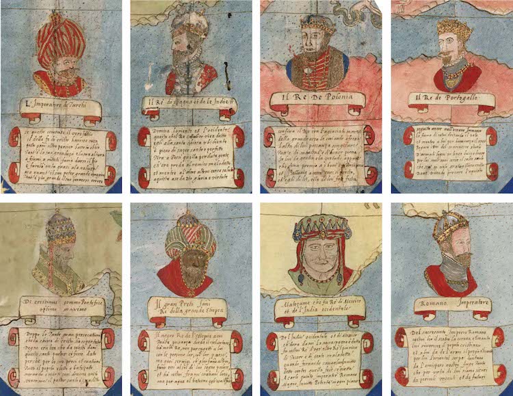
Portraits of leaders from twelve different folios
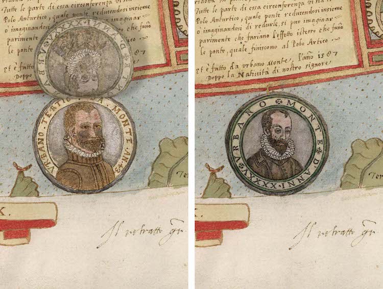
Portraits of Urbano Monte. Two years after the map was finished, but under revision, Monte added a new self-portrait pasted on top of his old on. As it is hinged, it's possible to lift up.
Monte also included climate, changes to the amount of daylight, and distances within regions in addition to geographic information.
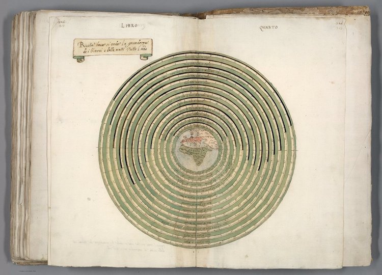
Chart showing length of days and nights during different times of the year
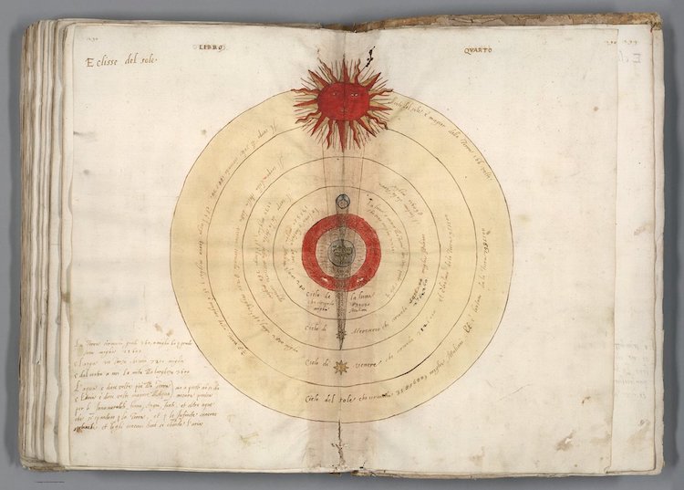
Eclipse of the sun
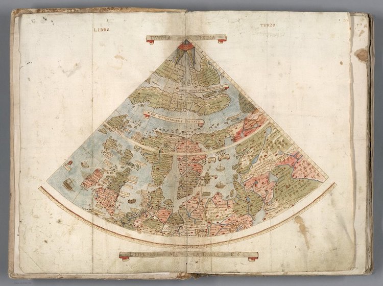
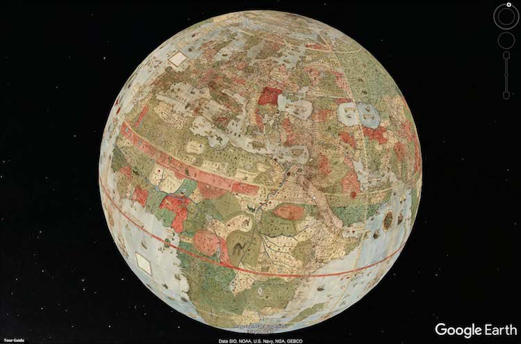
After re-projecting the map, Rumsey was able to place this historical hand-drawn map on Google Earth.
Monte's Planisphere georeferenced and re-projected as Plate Caree or Geographic
David Rumsey Map Collection: Website
My Modern Met granted permission to use images by David Rumsey Map Collection.
Related Articles:
Behind the Scenes: How the British Library Digitizes One of the World’s Biggest Books
509-Year-Old Map Is the Only Known Copy of First Time “America” Appears
Medieval Illuminated Manuscript Exploring the Majesty of Animals Digitized and Placed Online