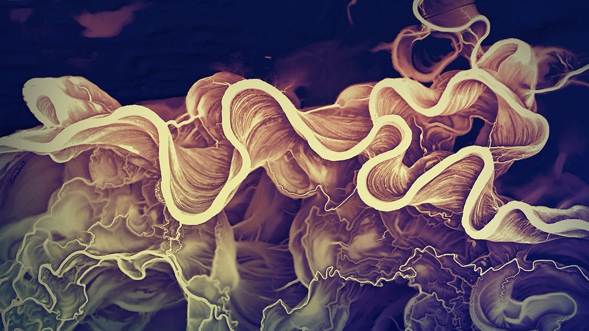
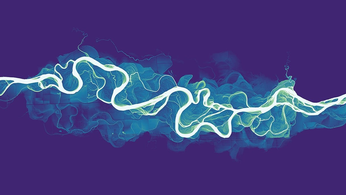
Murray River (Australia)
This post may contain affiliate links. If you make a purchase, My Modern Met may earn an affiliate commission. Please read our disclosure for more info.
Graphics editor Daniel Coe has always been captivated by maps, and his love of cartography has only grown over the years. For the past several years, he has been creatively using this passion to make stunning artwork focused on the world's rivers. Coe takes advantage of open-source lidar data to put together evocative maps that tell the history of these rivers and deltas.
His artistic images are both aesthetically pleasing and vitally important to understanding the imprint of these waterways. Lidar data not only shows the current path of the rivers but also allows users to see their former paths. Each image that Coe creates is a visual timeline of each river's history.
Coe is enthusiastic about sharing his work with the public. He makes all of his river images available for high-resolution download; and through Society6, it's possible to purchase art prints, mugs, pillows, and much more with these images. His website also has helpful tutorials for anyone who is interested in learning how to work with lidar data.
We had the pleasure of speaking with Coe about the origins of his passion for cartography and his creative process. Read on for My Modern Met's exclusive interview.
Yellowstone River (USA)
Where does your love of cartography stem from?
My love for cartography began at an early age. My parents had a long-running subscription to National Geographic Magazine, and I remember pouring over many of the remarkable Nat Geo maps as I was growing up. I also would plan long-distance bicycle trips as a teenager with local county atlases that my family had.
I studied both visual art and geography in college and found my way naturally to cartography, which is at the crossroads of those interests.
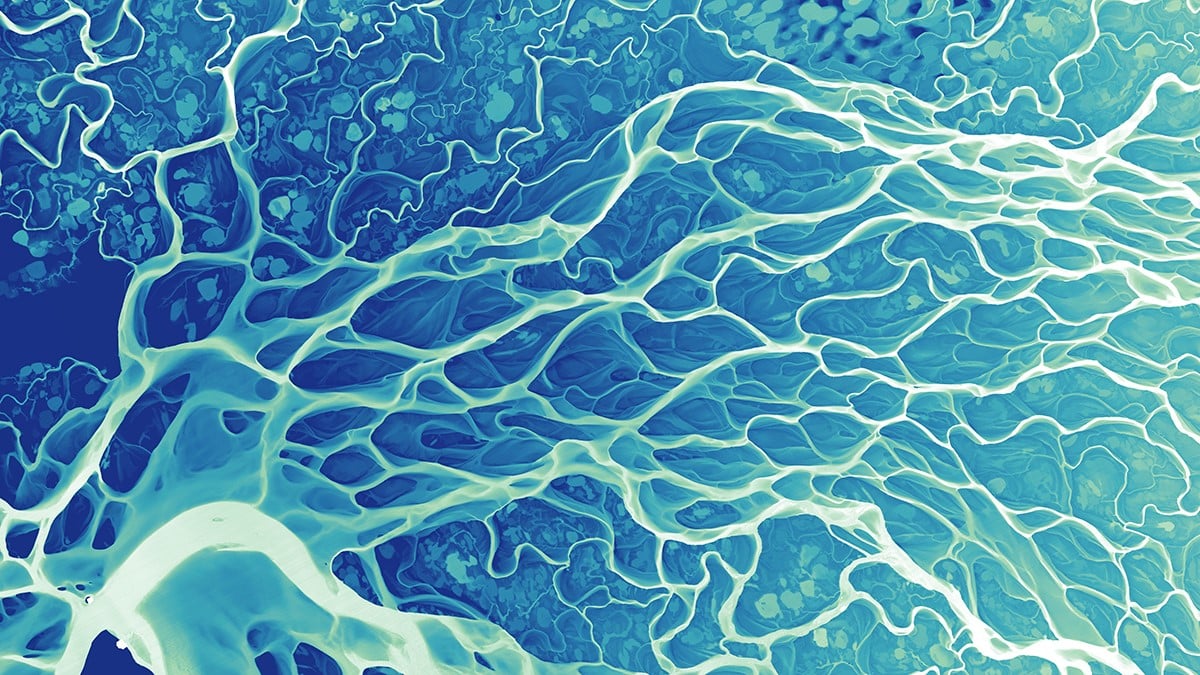
Lena River Delta (Russia)
What inspired you to create this series?
I had created an interesting lidar image of the Willamette River in Oregon many years back, and I wondered if I could make equally striking images of other rivers around the world. I had been wanting to learn QGIS, an open-source Geographic Information Systems software, and I realized around that time that many countries and states were publishing tons of new open lidar data. This treasure trove of new data ended up providing a great medium to experiment with interesting river visuals and to satisfy a curiosity about the natural world (as well as to learn QGIS). Since then, it has turned into a bit of an obsession.
Mississippi Delta (USA)
Can you explain what Lidar data is and why it makes the perfect source for these images?
Lidar stands for light detection and ranging or light radar, depending on who you ask. Airborne lidar is collected from a sensor in a plane that rapidly emits light pulses at the ground, which then are reflected back to the sensor. This information is converted into billions of data points that produce an accurate model of the earth’s surface called a point cloud. These point clouds can then be used to create continuous three-dimensional surfaces, also known as digital elevation models. For many applications, including river visualization, trees and structures can be digitally removed to create what is known as a bare-earth surface, or digital terrain model. This type of model is very useful for showing the “fingerprints” that rivers have left upon the landscape over hundreds and sometimes thousands of years.
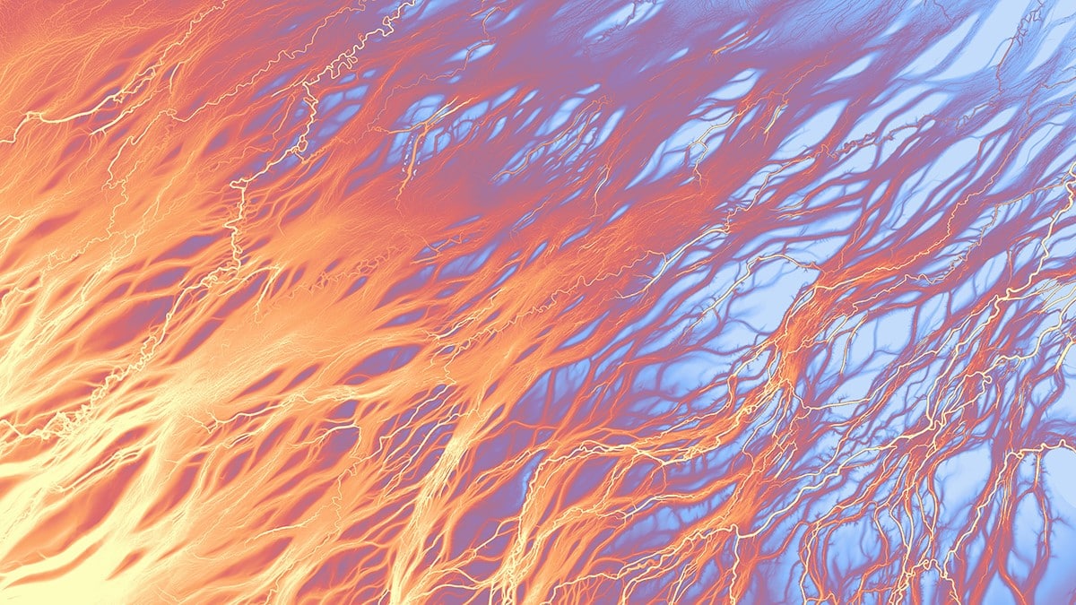
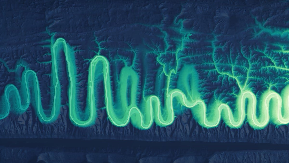
Cooper Creek (Australia)
How long does it take you to create an image, and do you go into the process with an idea in mind already?
The images themselves take varying amounts of time to produce, depending on many factors, including processing and editing time. Once I have identified and downloaded the data, I generally have a rough idea about the type of image that I want to create, but that often changes throughout the process, as I experiment a lot with color.
I spend a significant amount of time exploring the world virtually and looking at river data on lidar portals in different locations.
North Fork Shenandoah River (USA)
What's the most satisfying part of creating these images? The most challenging part?
Being able to visualize rivers in ways that they have never been seen before is incredibly satisfying. These images almost serve as an x-ray of sorts, in the way that they reveal the hidden pathways where rivers have flowed over time. One challenging aspect of making these images is that many of the world’s rivers have been engineered to the point of being unrecognizable as dynamic, living entities. Many of these places can be difficult to work with visually since their past channels have been obscured permanently by reservoirs or other obstructions.
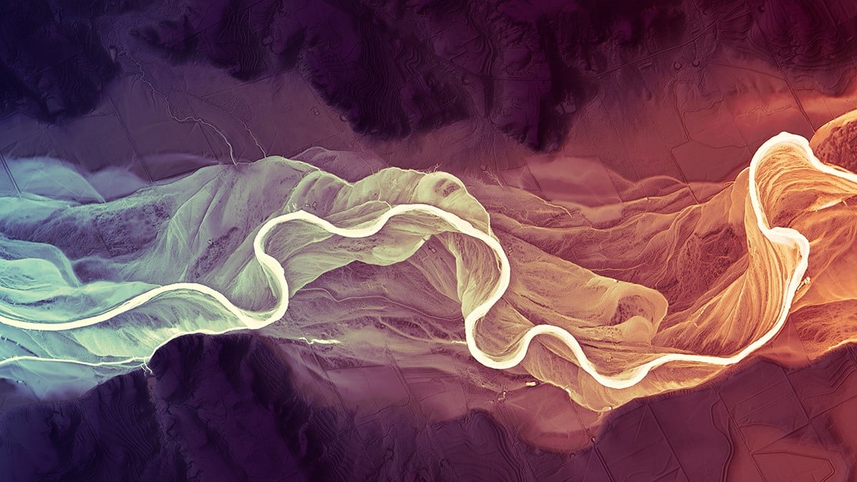
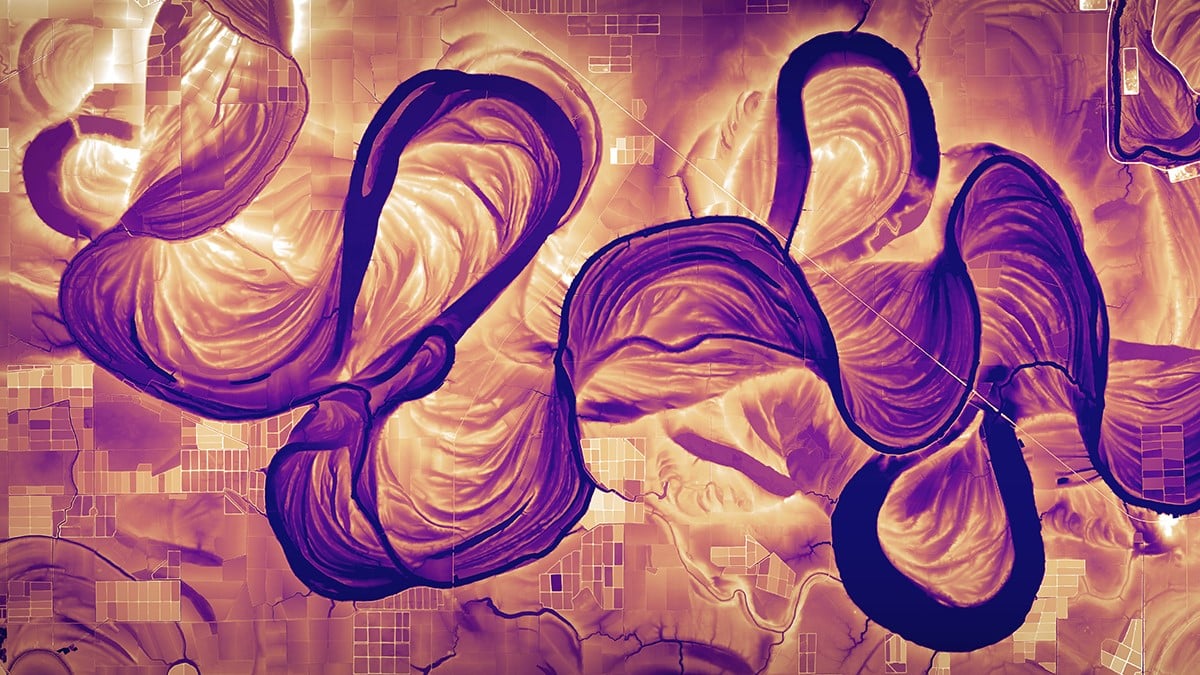
Brazos River (USA)
Why was it important for you to share the 4K versions of these with the public?
I love sharing these with the world! Making these images has provided me with a great creative outlet and the opportunity to learn about so many interesting places around the world. Sharing them just seemed like the next logical step—no reason to keep them to myself.
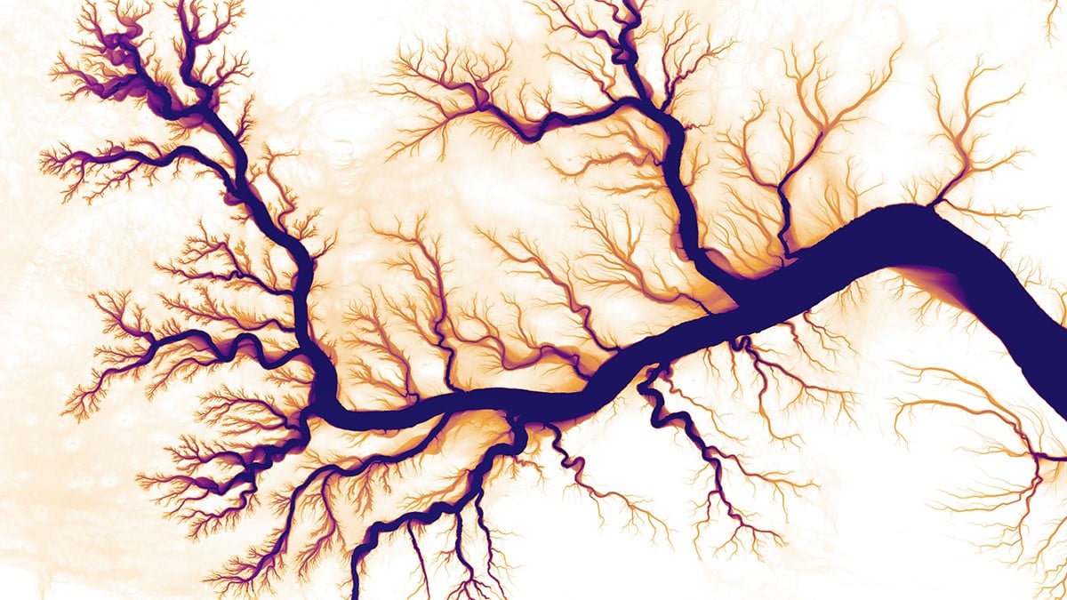
Colorado River Delta (Mexico)
What do you hope that people take away from the images?
I hope that people can take away a sense of curiosity about the world around them. Ideally, that curiosity will turn into a desire to care for their local environment (and rivers).
The sense of geologic time that some of these images convey also has a way of humbling us as human beings and putting our relatively short lives in perspective—which is a good thing.