This post may contain affiliate links. If you make a purchase, My Modern Met may earn an affiliate commission. Please read our disclosure for more info.
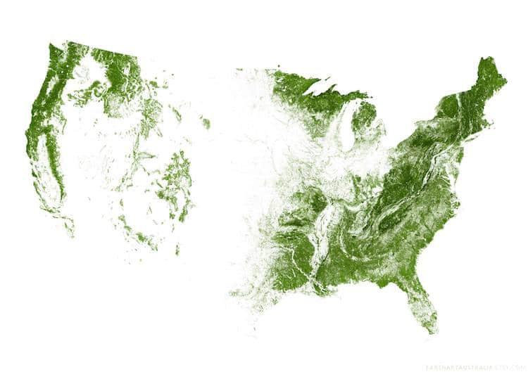
Cartography experts EarthArtAustralia specializes in creating “ultra-detailed maps of Earth from Space.” And after tackling the roads and rivers of the United States, they've just released a stunning map of the country using its forests. Over a billion acres of trees and forests, pulled together with imagery from the Landsat satellite, come together to present an interesting view of America.
A detailed look at different portions of the United States shows the vegetation as a velvety green layer creeping through sections of the country. The company used images from the spring growing season to highlight the vibrant and vital forests throughout the map. But how were they able to weed out other plants from the satellite images to be sure we're only looking at trees? It's all about wavelengths.
The company explains, “[Landsat] takes photographs of the Earth in red, green and blue wavelengths like our eyes can see, but also a bunch of other wavelengths that are invisible to us (near infra-red, short-wave infra-red, thermal infra-red etc). Essentially, different kinds of vegetation reflect different combinations of all those different types of light, so you can train a computer model to separate the different types of plants automatically!” Using open-source data on Global Forest Change originally published by M.C. Hansen and others in the December 2013 issue of Science, the company was able to pull the maps together.
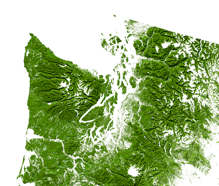
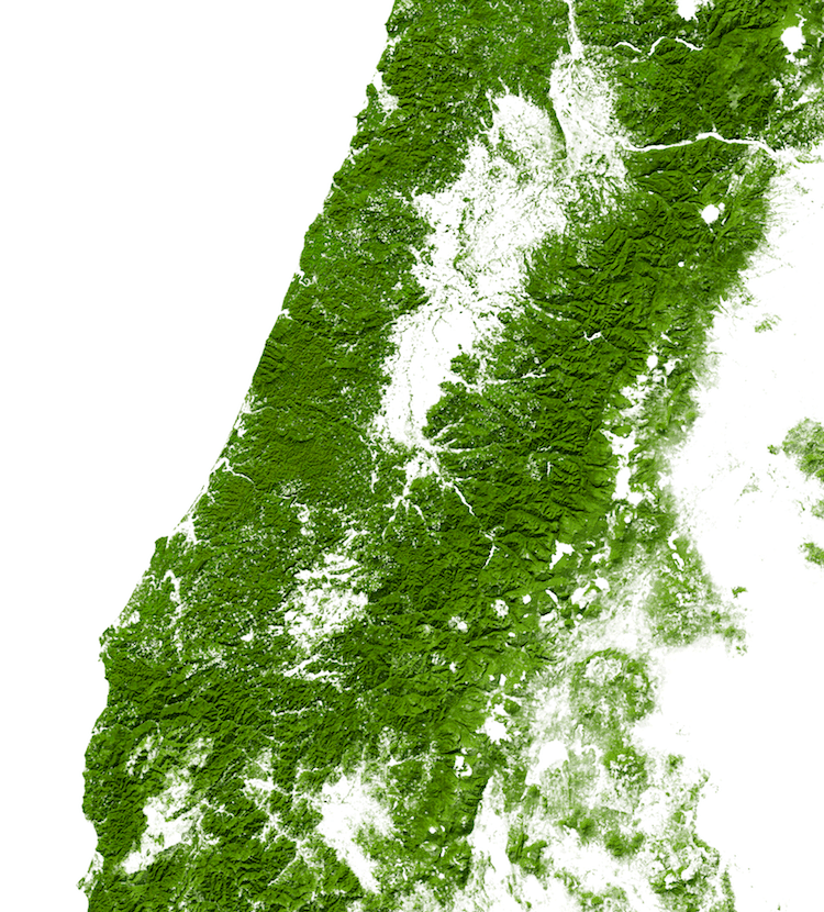
Olympic National Park and the northern Cascades, Washington state
Some have pointed out that it appears the model is also weeding out the large pine and juniper forests found in Texas, northern Arizona, and western Colorado, which appear white on the map. It's possible that the needles reflect light more similar to that of shrubs, and got pulled out in the process. But overall, it's an interesting way to think about the land makeup of the United States.
And, if you want the map for yourself, the company sells two versions on Etsy. One is a file you can print yourself, while the other is a museum quality poster print on archival matte paper. There are also details of certain areas of the country, such as Florida and Washington, available for sale as well. And the nice part is, 10% of all sales go to environmental conservation research, so you can also give back while getting a beautiful piece of map art.
Details of the satellite map show an incredible 1 billion acres of trees and forests across the United States.
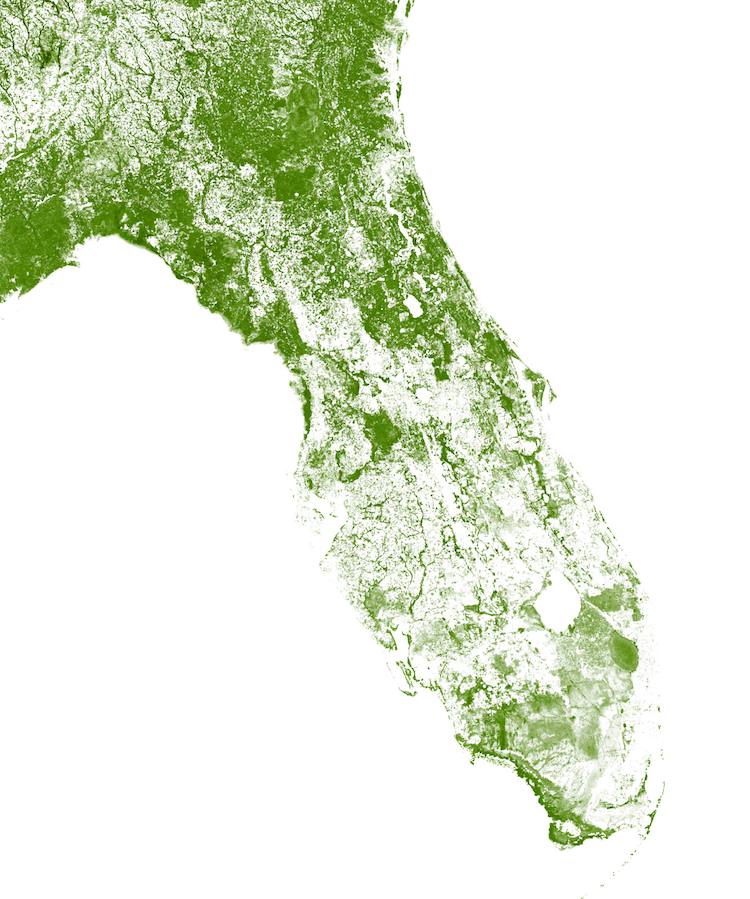
Forests of southern Florida

Forests of Hawaii and Alaska
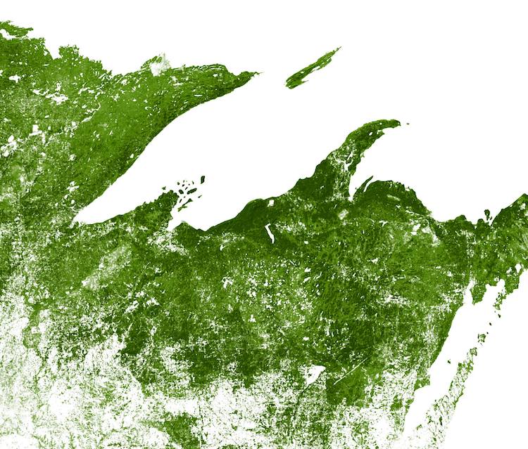
Forests of Minnesota, Wisconsin and Michigan
Forests of Northern California and Oregon
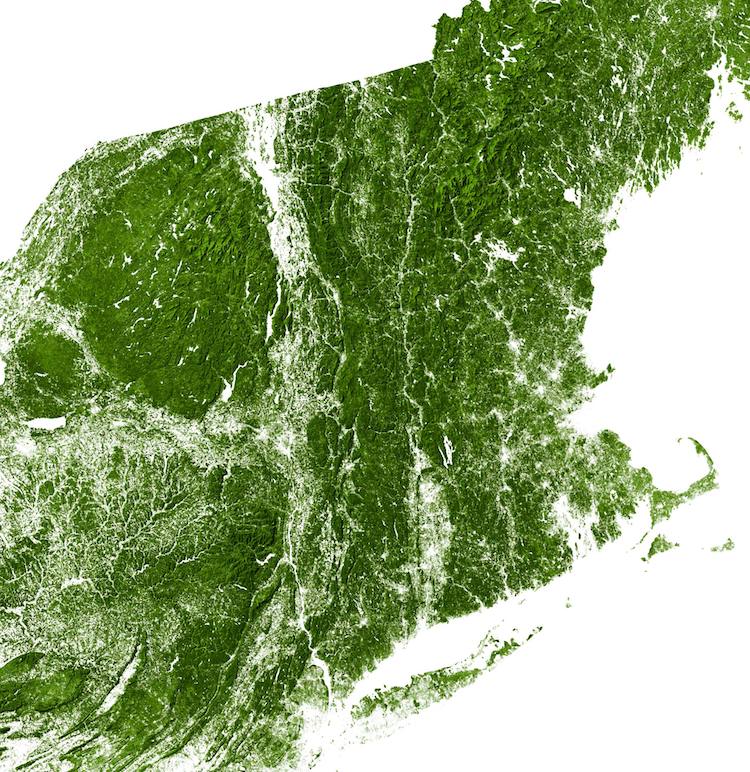
Forests of the Northeast
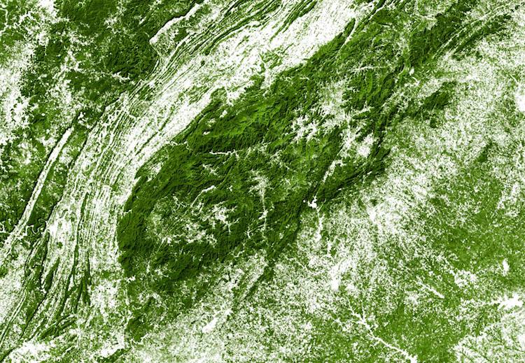
Chattahoochee National Forest and the Great Smoky Mountains

Forests of Louisiana

Forests of the northern Rocky Mountains
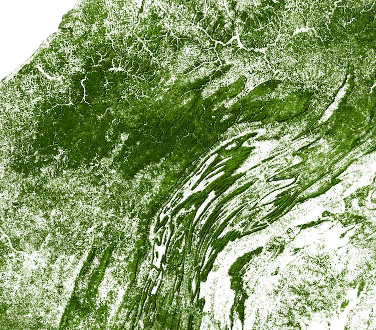
Northern Pennsylvania and the Appalachians
EarthArtAustralia: Etsy | Facebook
h/t: [reddit]
All images via EarthArt Australia.
Related Articles:
‘220 Mini Metros’ Turns World Transit Networks into Tiny Minimalist Maps
21 Informative Maps That Will Change Your Worldview
National Geographic Now Lets You Print Thousands of Free Geographical Maps from Home