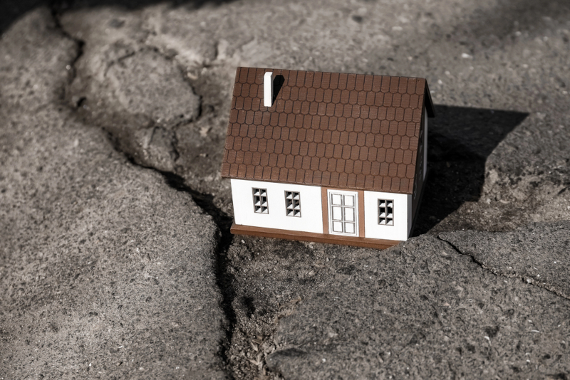
Earthquakes are a scary yet common reality for many people, particularly in areas prone to these movements, such as Japan. Since these events happen at a massive scale, it's hard for many to grasp how they occur and what causes them. One of the simplest, yet best explanations, is homed at the Osaka City Museum of Natural History. An insightful model there shows how earthquakes are formed miles below the ground.
“The Earth’s many tectonic plates can be thousands of miles across and underlie both continents and oceans,” says the United States Geological Service (USGS). “These plates collide, slide past, and move apart from each other. Where they collide and one plate is thrust beneath another (a subduction zone), the most powerful earthquakes, tsunamis, volcanic eruptions, and landslides occur.”
The model depicts a subduction fault, in which one patch of earth known as an oceanic plate is being pushed under another. In Japan, this is the convergence of four plates—The Pacific Plate, The North American Plate, The Eurasian Plate, and The Philippine Plate—while in the western U.S., the Juan de Fuca Plate slides beneath the North American Plate, resulting in the Cascadia Subduction Zone.
The model depicts a tiny city attached to a metal sheet. The bottom part is connected to a block that is continually rolling; however, the friction is unpredictable. At some points, the metal sheet glides smoothly, but when it becomes stuck, it sends powerful waves to the small city on top. The more stuck it gets, the larger and more powerful the waves it sends become. (If you want to see how it works in real life and how these movements create tsunamis, check out this animation by the Alaska Earthquake Center.)
Knowing how earthquakes work is not only key in helping us know the inner workings of our world better, but also in developing safer construction systems and understanding the importance of emergency drills and evacuation protocols. To learn more about how architects and engineer keep people safe, check out the Earthquake Building Technology display. To stay up to date with everything related to earthquakes, visit the United States Geological Service website.
An insightful model at the Osaka City Museum of Natural History shows how earthquakes are formed miles below the ground.
This model shows how earthquakes are formed
byu/NavyLemon64 ininterestingasfuck
This phenomenon can also be also explained with this animation by Alaska Earthquake Center.
This Earthquake Building Technology model shows how architects keep people safe.
Sources: This model shows how earthquakes are formed; Introduction to Subduction Zones: Amazing Events in Subduction Zones; Generation of a tsunami by a subduction zone earthquake
Related Articles:
Japan’s “Tsunami Stones” Have Been Warning Residents of the Dangers of Earthquakes for Centuries
Restored Footage Gives a Taste of San Francisco Before the 1906 Earthquake
Mexico Sends Its Search and Rescue Dogs to Turkey to Help in the Search for Earthquake Survivors
Giant “Helping Hand” Artwork Brings Message of Hope Amidst Rubble From Turkey’s Earthquake