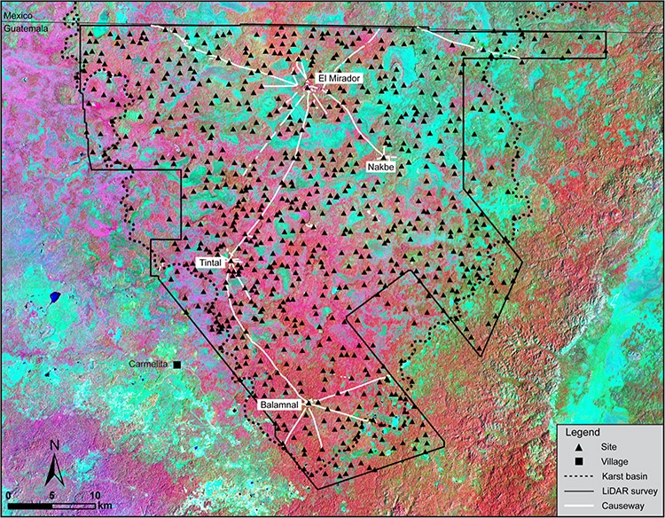
Mayan sites and causeways in the Mirador-Calakmul Karst Basin (MCKB). (Photo: Hansen et al.)
The ancient Maya of Central America created incredible civilizations. With their water filtration systems, mathematics, stone pyramids, and detailed calendars, the Maya dominated the region for hundreds of years. The Mayan Empire peaked in what is known as its classical period from 250 C.E. to 900 C.E. However, in the proceeding preclassical period from around 1800 B.C.E. to 250 C.E., the Maya were expanding and developing their settlements in the lowlands. Researchers recently published an analysis of one of these early civilizations, a 2,000-year-old network of 964 settlements connected by causeways.
The structures were discovered using LiDAR, a laser system that can scan through rainforests to discover hidden architecture. LiDAR can cover huge swaths of land; it has already been used to discover many Olmec and Mayan settlements in the dense forests of Central America. The recent study exposed more than 775 ancient Maya settlements within the Mirador-Calakmul Karst Basin (MCKB) region of Guatemala and 189 more in the surrounding karstic (limestone irregularity) ridge. Many of the settlements—independent architectural clusters—are connected by 110 miles of elevated dirt causeways. This interconnectivity implies the region's inhabitants had rich economic, political, and social ties.
The laser technology also revealed monumental architecture in many of the settlements. This includes platforms and pyramids which were used for ritual and entertainment purposes. Ball courts were also spotted, where inhabitants played regional versions of ball games. Reservoirs and canals indicate a sophisticated water delivery and storage system. The penultimate example of a preclassical Mayan city is El Mirador, an already-known settlement. Abandoned about 2,000 years ago, it was home to 200,000 people. Its enormous pyramids, platforms, and temples outshine later classical Mayan cities.
The LiDAR imaging of the region offers insight into what the authors of the recent paper call “the formation of a unified ‘kingdom' in the MCKB [which] may have emerged as smaller entities were absorbed into a larger hegemony, an alternative model to that proposed by Clark for the Middle Preclassic kingdoms of the Western Maya Highlands.” The connections between the settlements indicate a Mayan civilization even more advanced at an early date than previously known. While even more archeological revelations likely await discovery with LiDAR technology, the sheer scope and sophistication of ancient Mayan civilization is already awe-inspiring.
Researchers using LiDAR laser technology have discovered a complex ancient Mayan civilization in Northern Guatemala.
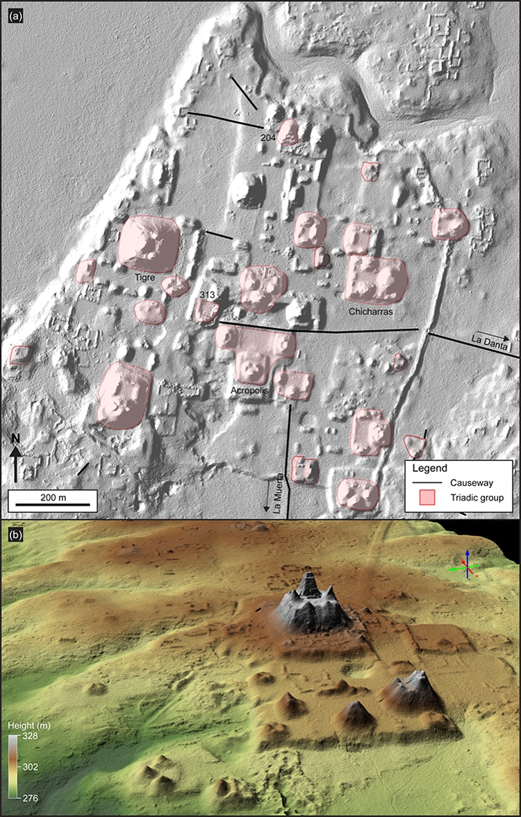
(a) LiDAR image showing triadic structures in the civic center of El Mirador (b) LiDAR 3D view showing the pyramidal complex of La Danta, located on the east side of the civic center at El Mirador.(Photo: Hansen et al.)
The civilization comprises about 1,000 towns spread across an area of around 650 square miles, connected by raised causeway roads.
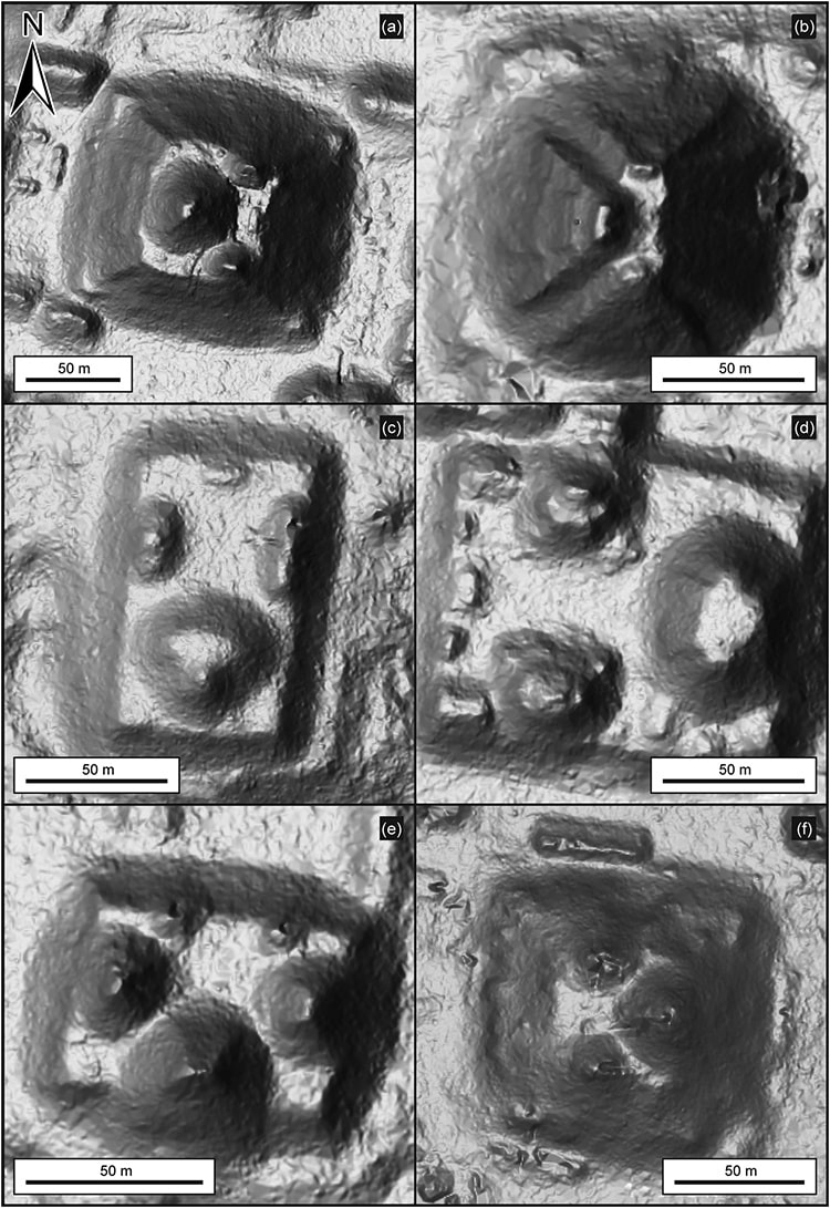
LiDAR images of selected triadic monumental structures. (Photo: Hansen et al.)
The civilization flourished around 2,000 years ago.
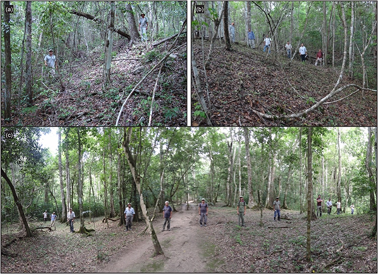
Causeways in the forest. (Photo: Hansen et al.)
h/t: [Interesting Engineering]
Related Articles:
Laser Technology Discovers 11 Historic Hidden Settlements Under Amazon Rainforest
Laser Mapping Unearths 60,000 Ancient Maya Structures in Guatemalan Jungle
168 New Geoglyphs Discovered Among the Nazca Lines in Peru
Dual Mayan Stele Featuring a Female Deity Is Unearthed in Southeastern Mexico


