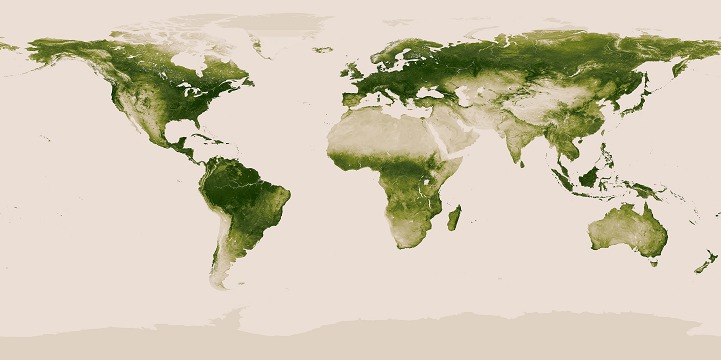
The NOAA (National Oceanic and Atmospheric Administration) has just released a vivid, high-resolution interactive map charting Earth's plant life. Utilizing a year's worth of data, which amounts to over 100 terabytes, collected from NASA's Suomi NPP Satellite, the rendering offers an extraordinarily detailed look at where the planet's highest (and lowest) concentrations of vegetation can be found. From a view of the whole planet, you can see wide swaths of green forests and sandy expanses of desert, while zooming in reveals the fine, vein-like channels of rivers and patches of plant-sparse urban areas.
The satellite, which makes 14 complete orbits per day, gauges the amount of plant matter on the planet's surface by using infrared, microwave, and radiometric sounding instruments to measure how much plant-specific energy is reflected back into space. Along with providing this richly green marvel for casual viewers, the data in this graphic can be used to help anticipate climate change and severe weather patterns. Whether you're an amateur or scientist, the fruits of this intensive research provide a gorgeous view of the fascinatingly varied topography of our world.

Nile River Delta
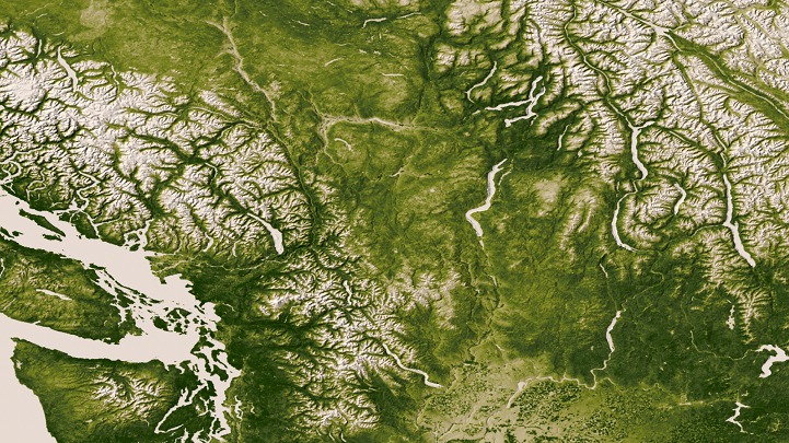
Pacific Northwest

Mississippi River Delta

The Everglades

Nebraska
NOAA website
via [Inhabitat]