Muir Way | $89+
USA Geologic 1932 Relief Map, created from a scan of the 1932 original by cartographer Sean Conway.
In the olden days, every motorist had a clunky road atlas and flimsy paper maps. Now, digitized maps of the world are at your fingertips. Since ancient times, maps have informed users of their geological surroundings. However, they are also a fascinating record of change in how humans understand the Earth. Building off this long tradition of mapmaking, cartographer and ortho-imaging specialist Sean Conway uses modern expertise to enhance vintage maps with accurate elevation data. An ongoing project, the maps are available as stunning prints that defy the eye to appear as three-dimensional reliefs.
Trained in geography and cartography, Conway started the vintage map relief series as a personal project. For each piece, he begins by choosing a specific vintage map from a wide variety available in public domain high-resolution online scans. Next, elevation data from scientific databases must be layered onto the map—think of it as pressing another map on top; they must line up. In order to add the properly scaled data, Conway must first georeference the older map. To georeference a map is to determine exactly what area it represents and what projection it depicts—meaning the scale, longitude, and latitude lines must match the modern mapped elevations. Some maps have been georeferenced already, including some by the U.S. government. Others are old and technically inaccurate. For such projects, Conway warps the elevation data to maintain the vintage map's form.
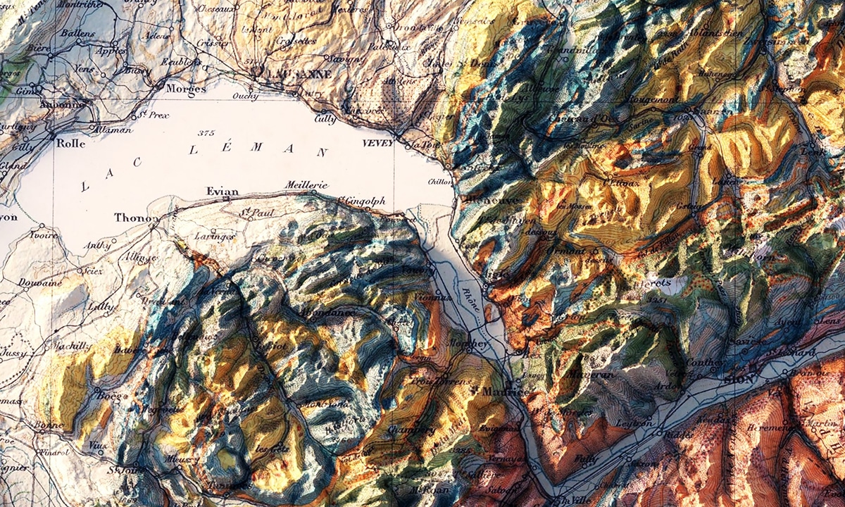
A close up of Lac Lemain on the Switzerland map, Geologische Karte der Schweiz 1911.
After the vintage map is georeferenced, that data is entered into a geographic information system (GIS) software called ArcGIS Pro. In this software, cartographers can crunch data, as well as create 2D and 3D maps and models. Here Conway can process the elevation data within the georeferenced map, in essence aligning the modern data with the old map. For the final touches, the project migrates to Blender, an open-source 3D creative software. The end result is a map that retains all the vintage charm of the original, but with detailed modeling of elevation flawlessly superimposed. While many of the vintage maps were topological to begin, the hyperrealism of the 3D effect brings the geological features to life.
Since starting the project, Conway has completed many vintage relief maps—areas represented include Alaska, Switzerland, the Grand Canyon, Brazil, Crater Lake, and many more. While Conway is pleased that people think the maps are art, he says, “I'm far happier to hear when people tell me that it helped them to understand or better visualize geologic or geographic properties of the earth…Or how the 3D maps help them understand physical processes. It's really interesting to see the geological color delineation in a map in addition to the 3D effect. You can really see where geological phenomena change simply by upthrust or exposed valleys.”
For the scientist or nature lover in your life, high-quality prints are available in varying sizes on Muir Way—they make perfect gifts, especially for those who love the outdoors.. To stay up to date on Conway's ongoing vintage relief map project, you can follow him on Twitter.
Cartographer Sean Conway combines vintage maps with modern elevation data for a stunning 3D effect.
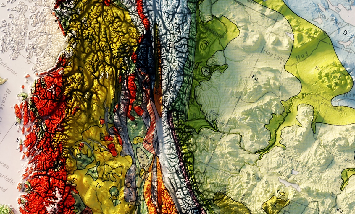
A close up from the Canada 1956 Relief Map, based upon a map from the Department of Mines and Technical Surveys.
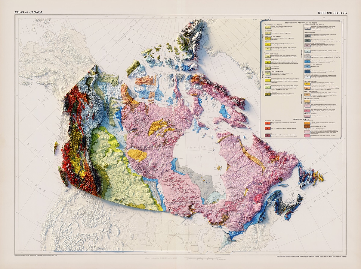
Canada 1956 Relief Map
Choosing vintage maps available online, Conway georeferences each map—lining it up with data points which can be entered in a geographic information system (GIS).
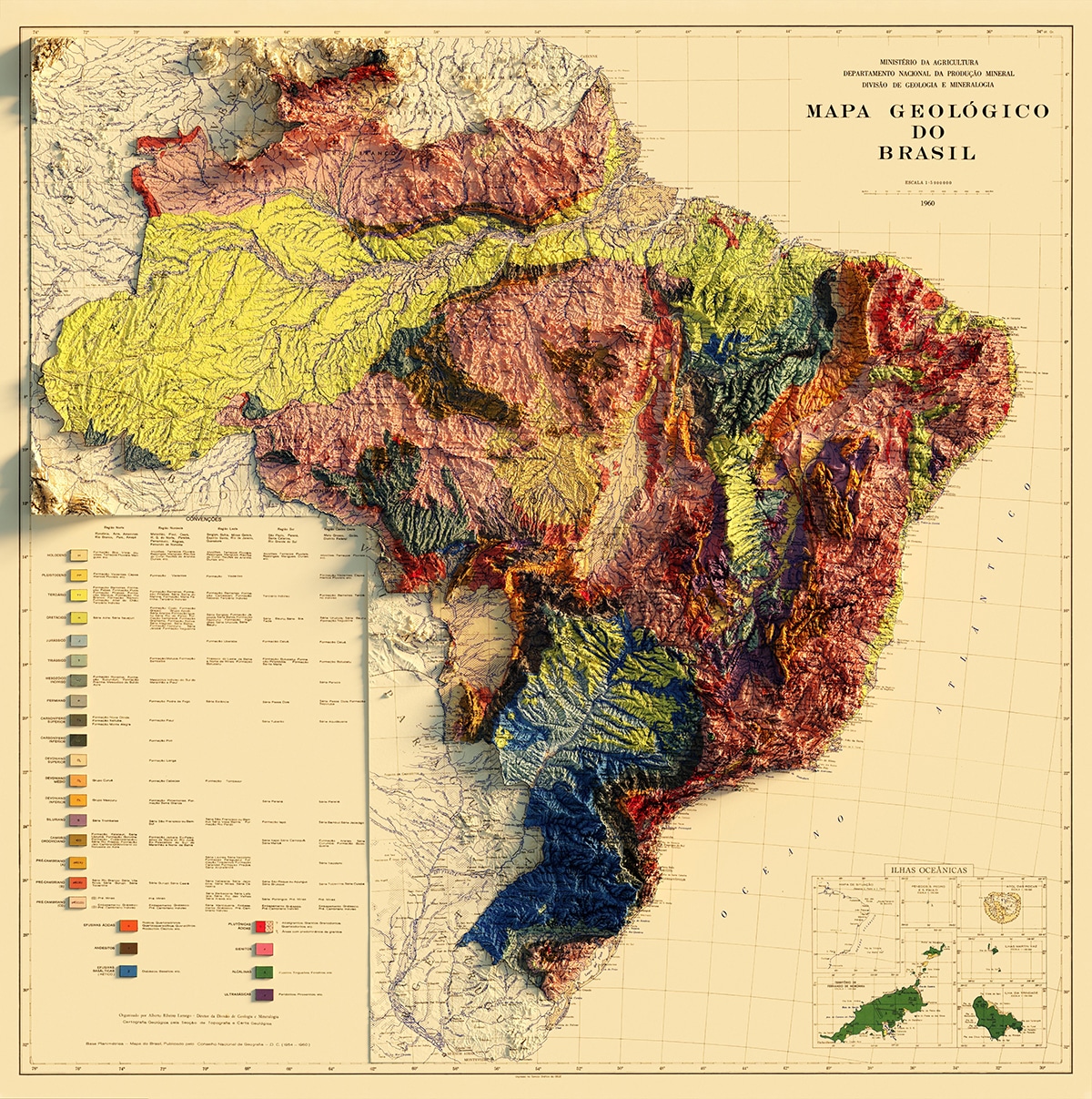
Brazil 1960 Relief Map
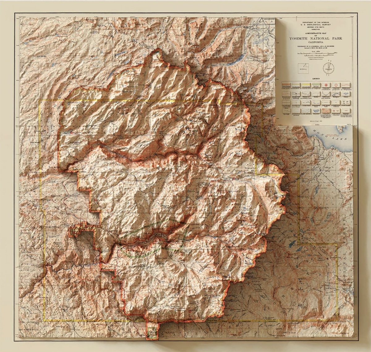
Yosemite 1910 Relief Map
Once the vintage map is georeferenced, it can then be combined with detailed elevation data in 3D GIS software.

Spain and Portugal 1879 Relief Map
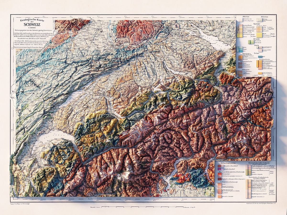
Geologische Karte der Schweiz 1911
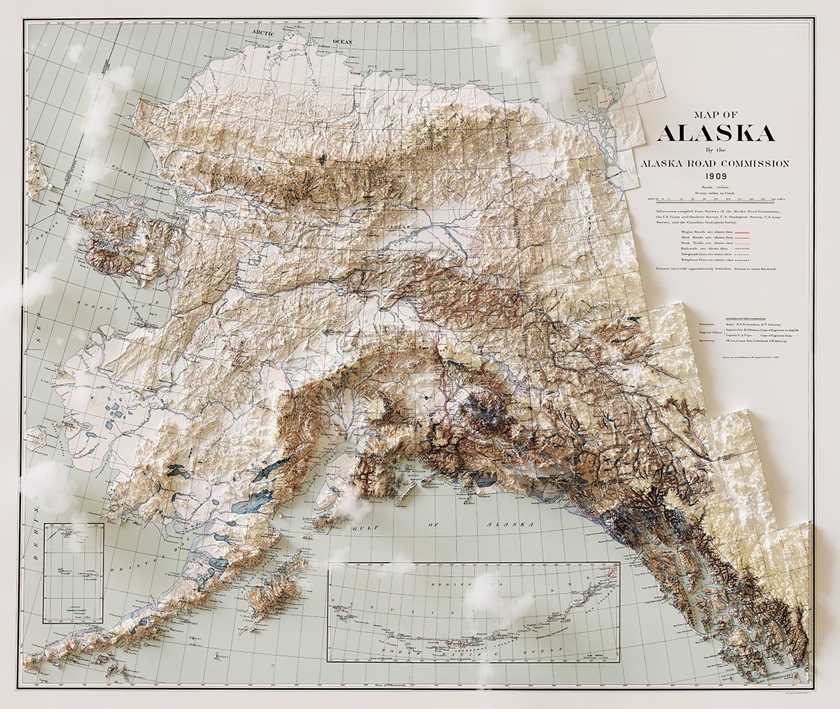
Alaska 1909 Relief Map
Adding finishing touches in 3D editing software Blender, the final vintage relief map is a stunning depiction of geology and geography.
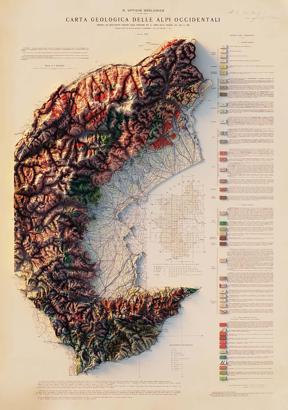
Alpi Occidentali 1908 Relief Map
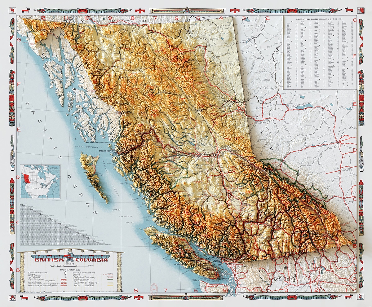
British Columbia 1948 Relief Map
Conway began the project for fun; but due to growing interest in his work, he began offering gorgeous art prints on Muir Way.
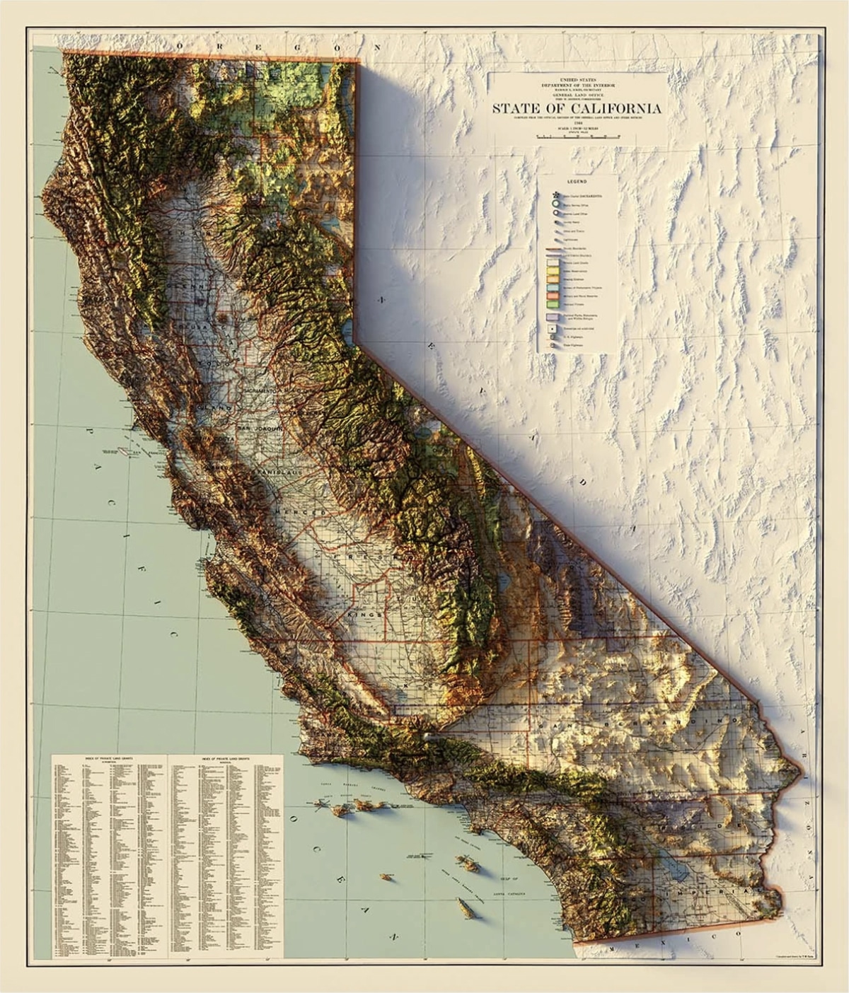
California 1944 Relief Map
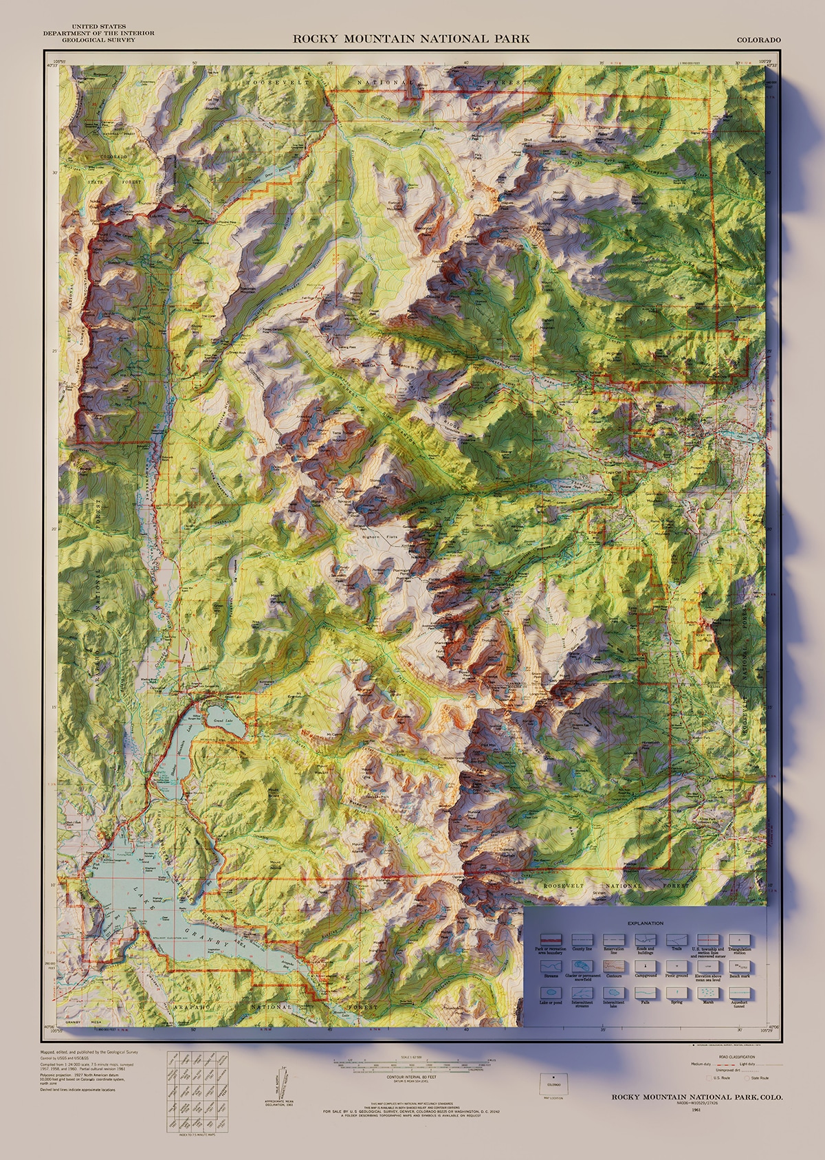
Rocky Mountain National Park 1961 Relief Map
Although his work is beautiful, Conway hopes it will also be educational and that viewers will see topography and geology in a new light.
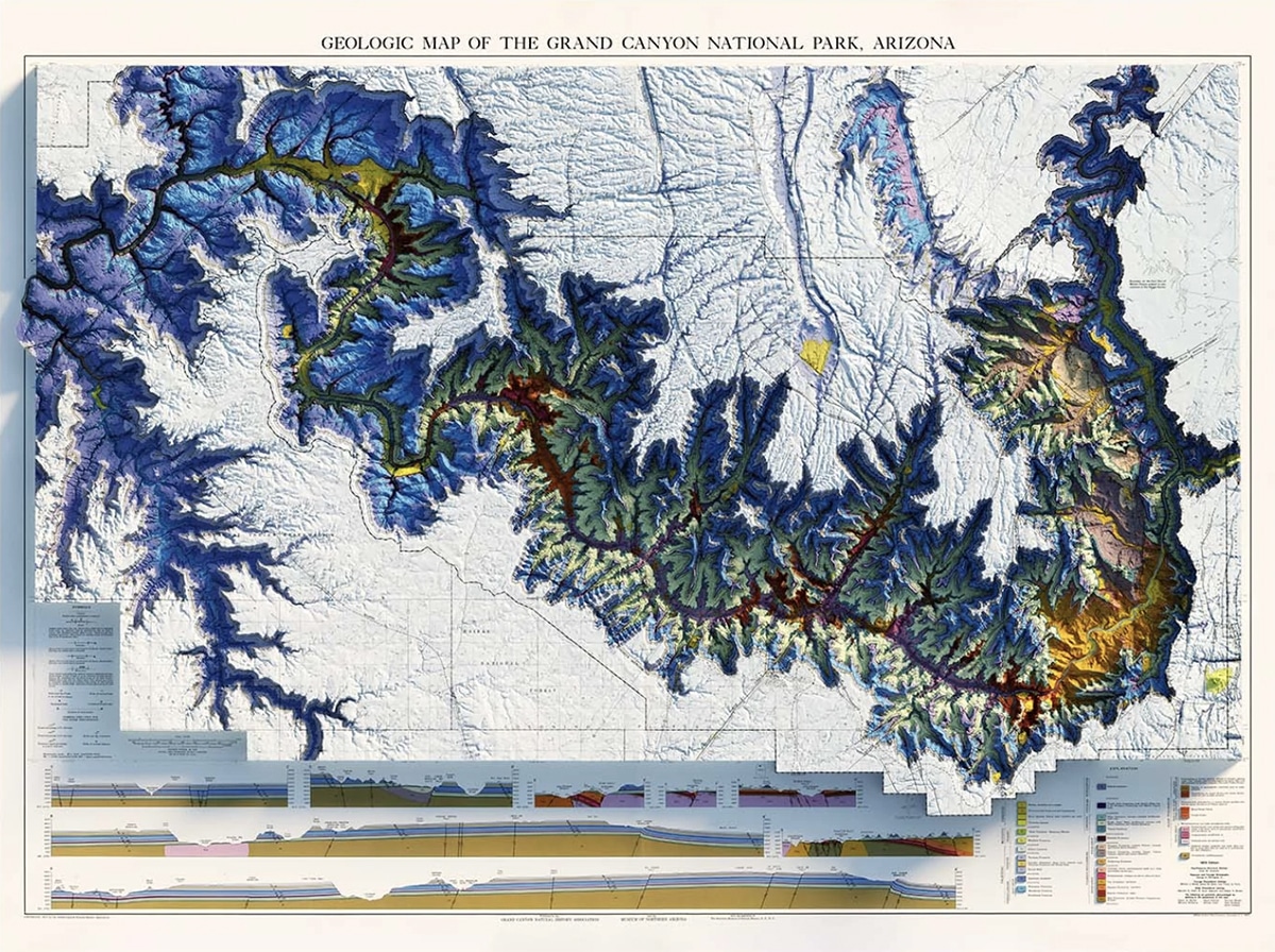
Grand Canyon 1976 Relief Map