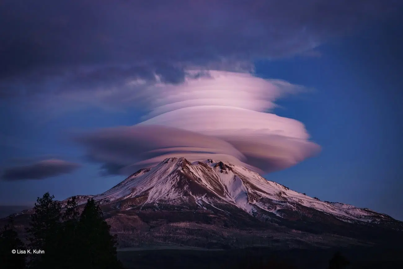
“Mount ShastaTop Hatat Sunset,” by Lisa K. Kuhn
With its smooth, stacked layers glowing in the evening light, this lenticular cloud looks almost as though Mount Shasta has dressed up for the occasion. Located in northern California, USA, the 14,000-foot volcano is a well-known spot for these striking cloud formations, which can resemble giant saucers, stacks of pancakes, or even classic UFO imagery.
Lisa Kuhn had already been photographing the mountain when she decided to head out again for a better view. “I dropped my husband and our dog off at home, grabbed my tripod and headed to the end of the street for a better view of the mountain. I was surprised to see the lovely outcome of the photo with the smooth layers on the front of the cloud,” she recalls.
Despite their otherworldly appearance, lenticular clouds have a simple meteorological explanation. When moist, stable air flows towards a mountain, it is forced upwards and over, before sinking again on the other side. As the air rises, it cools, and water vapor condenses into clouds. As it descends, it warms and the cloud evaporates. This can happen repeatedly as air flows through mountain waves, allowing a cloud to remain in roughly the same position, even while air moves through it.
When the atmosphere contains several moist layers, lenticular clouds can form at different heights, creating the stacked appearance seen here.
While these formations have inspired plenty of UFO stories, Lisa saw something a little different: Mount Shasta wearing a “top hat.”
Weather can transform a landscape in minutes. Dramatic storms roll in, unusual clouds fill the sky, and fog, snow, or rain can make even a familiar place look completely different. The shortlisted images in the 2026 Weather Photographer of the Year competition capture these fleeting moments from around the world.
Organized by the Royal Meteorological Society (RMetS), the annual competition celebrates photographs that show weather in all of its beauty, power, and unpredictability. This year, more than 5,500 images were submitted, leaving judges with the difficult task of narrowing them down to the final shortlist.
The selected photographs capture everything from rare meteorological events to quieter moments shaped by changing conditions. Some also document the effects of climate change, showing how photographers can use striking images to tell a much larger story about what is happening to the world around us.
Now, the public can choose a favorite. Voting for the Public Favorite Award is open through November 5, 2026, at 11:59 p.m. GMT. Viewers can explore the full shortlist online, read the stories behind the photographs, and vote for the image that stands out most to them.
The competition offers several ways to view weather through photography. Alongside Weather Photographer of the Year, the contest includes a category for images taken on mobile devices, as well as the Climate Award, which recognizes photographs that tell a compelling story about climate change and its effects.
Together, the shortlist shows just how differently weather can be experienced depending on where you are in the world. Some photographs capture tense events that last only moments, while others reveal slower changes in familiar landscapes.
The public vote closes on November 5, and the winners will be announced on November 17. Until then, the full shortlist offers a fascinating look at the beauty, unpredictability, and sometimes destructive power of weather.
From unusual cloud formations to powerful storms, the 2026 Weather Photographer of the Year shortlist captures dramatic weather unfolding around the world.
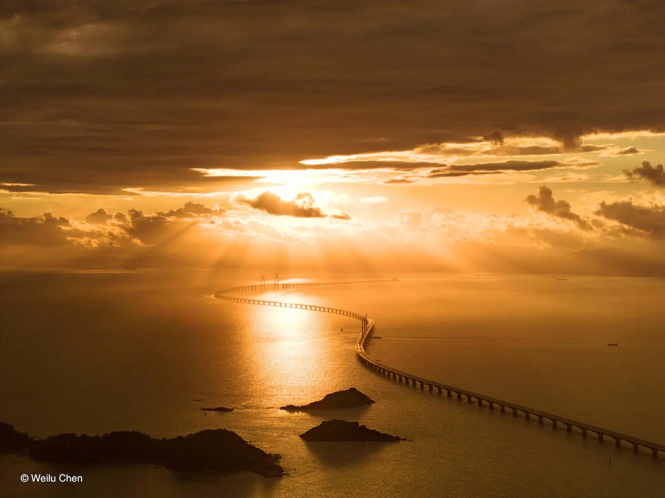
“Sunrise and Morning Glow” by Weilu Chen
Crepuscular rays are a phenomenon often seen when the Sun is low in the sky. They form when clouds or other objects block part of the Sun’s light, casting long shadows through the atmosphere. Sunlight streams through gaps in the clouds, made more visible by particles such as dust in the air, creating the bright rays separated by darker bands of shadow.
The golden colors are another result of the Sun’s position. When the Sun sits close to the horizon, its light travels through a much greater thickness of the atmosphere than it does around midday. Along the way, tiny air molecules scatter shorter blue and violet wavelengths more effectively than longer red and orange wavelengths. By the time the light reaches our eyes, warmer colors dominate, painting the clouds and landscape in shades of gold.
The calm water below adds another layer to the scene, catching the sunlight and extending its glow across the estuary.
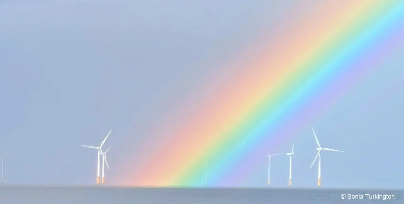
“Nature meets energy,” by Sonia Turkington
Off the coast of Ingoldmells, Skegness, England, wind turbines stand against the changing Lincolnshire sky. In this striking image, Sonia Turkington captured a moment where the natural atmosphere and human technology share the spotlight. The vivid rainbow stretching across the frame provides a dramatic backdrop for the rows of turbines, creating an image that feels both peaceful and powerful.
Wind turbines make use of the same natural forces that shape our weather. Wind forms due to pressure differences in the Earth’s atmosphere, primarily caused by temperature differences. The Sun heats the Earth’s surface unevenly, creating areas of high and low pressure. Air then moves from areas of high pressure to those of low pressure, and this movement of large air masses is what we call wind.
Turbine blades capture some of this kinetic energy, converting it into electricity. For the UK, wind has become a major part of the electricity system. Great Britain now has more than 32 GW of operational wind capacity across onshore and offshore wind farms, with over 26 million homes powered by wind in 2025.
For Sonia, however, the photograph is about more than renewable energy. “The combination gives the image a quiet symbolism of nature and technology sitting in harmony rather than conflict”, she explains.
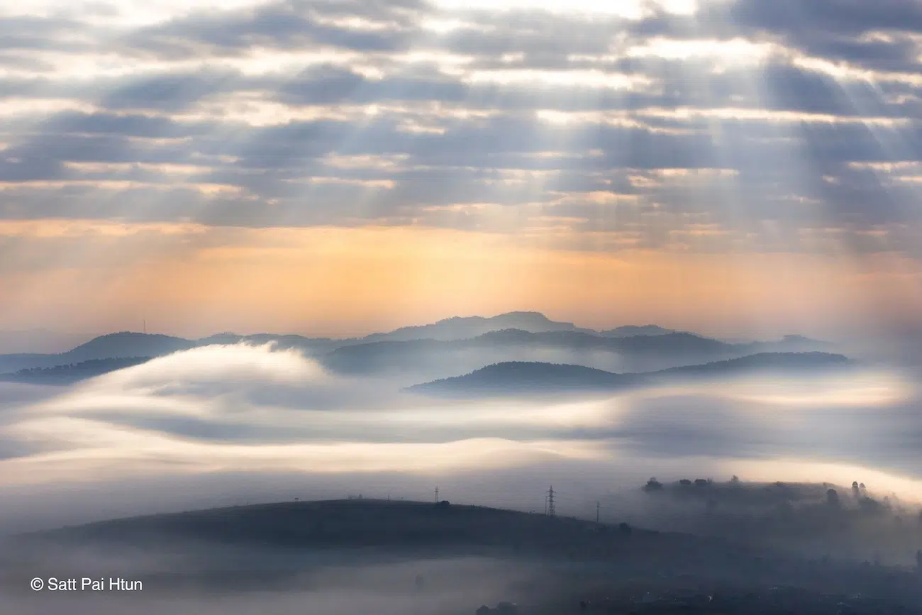
“Heaven From Earth,” by Satt Pai Htun
As the morning sun rose over Taungoo, Myanmar, a layer of cloud spilled through the mountain valleys, leaving the hilltops appearing to float above a soft white blanket. Rays of light broke through the stratocumulus clouds above, illuminating the landscape and creating this breathtaking scene.
This spectacular view is the result of a temperature inversion. Under typical atmospheric conditions, air temperature decreases with altitude, but during a temperature inversion, this pattern is reversed. In January, Myanmar is influenced by the northeast monsoon, which brings cooler, drier winter weather. The associated high-pressure conditions can favor clear skies and light winds, allowing the land to cool overnight. As air near the surface becomes colder and denser, it can settle into the valleys, while warmer air above acts like a lid, limiting vertical mixing.
Overnight, the hills lose heat, cooling the air close to the ground. When this air becomes saturated, moisture condenses into tiny water droplets, forming fog that settles into the valley. The inversion helps keep the fog trapped beneath the warmer air, creating the appearance of a vast ocean of cloud, with the peaks rising like islands above.
As Satt Pai Htun explains, the photo “highlights the quiet beauty of nature and the dynamic relationship between atmospheric clouds and morning light.”
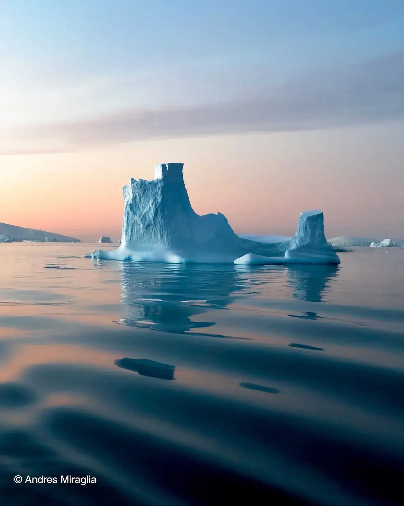
“Castles in the Wind” by Andres Miraglia
Icebergs like this are a natural part of the Antarctic landscape, created when pieces of glacier break away in a process known as calving. Once separated, they can drift with the ocean currents and winds, gradually melting as they travel through warmer waters.
While a single iceberg is not evidence of climate change, it poses as a stark reminder of how climate change is affecting the region. The Antarctic Peninsula is one of the fastest-warming regions on Earth. In some locations, temperatures have risen by around 3°C since the 1950s.
Glaciers are constantly in motion, with seasonal melting and growth being part of their natural cycle. Across Antarctic, some areas are losing ice rapidly, while others may be gaining ice through increased snowfall. However, surveys of the Antarctic Ice Sheet as a whole show that it is in decline, and has been for decades, with the largest losses of ice occurring in West Antarctica. Between 2002 and 2023, Antarctica lost an average of around 150 billion tonnes of ice each year.
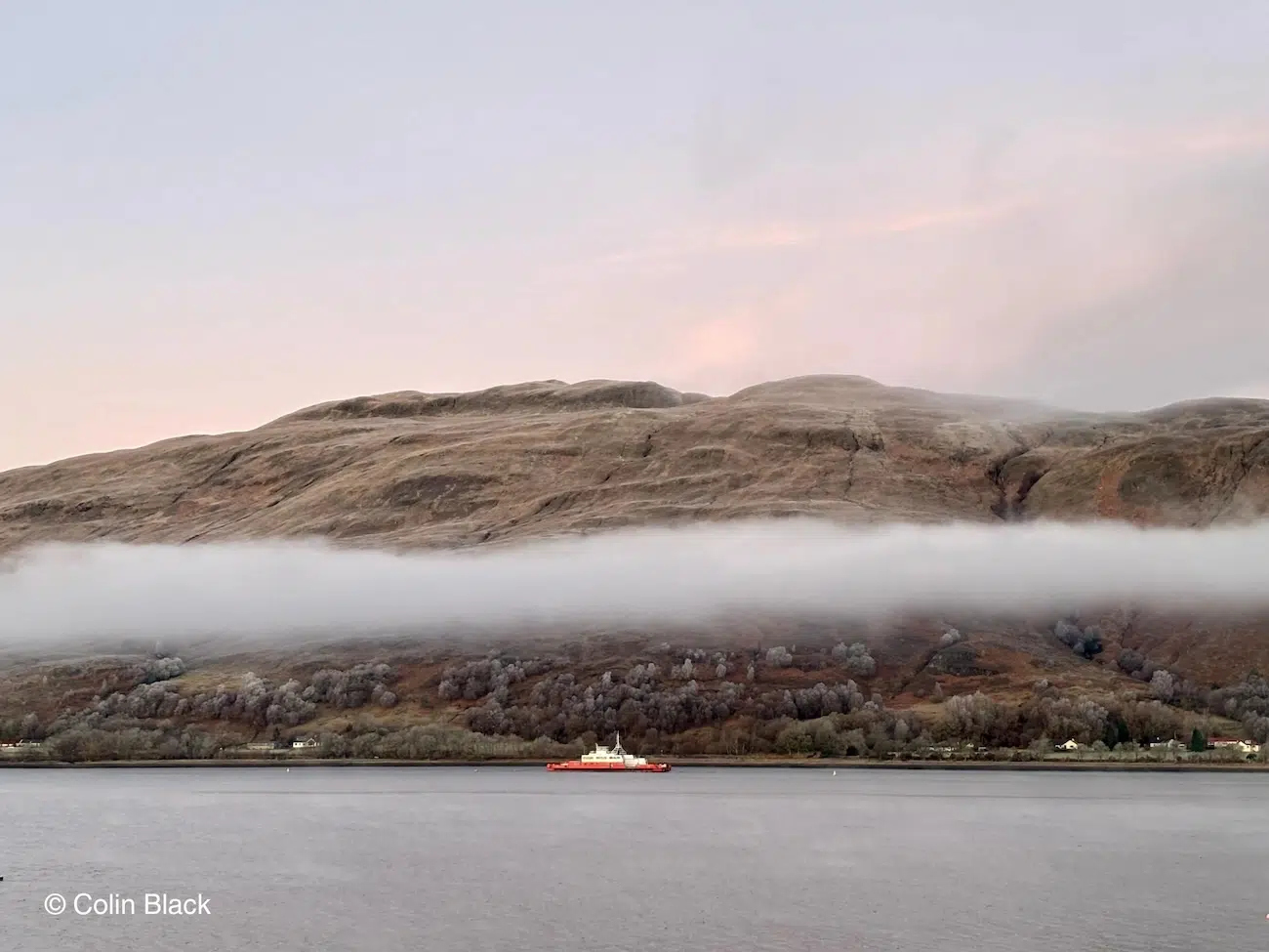
“Loch Linnhe,” by Colin Black
Looking towards the frost-covered hills surrounding Loch Linnhe, Scotland, Colin Black “wrapped up against the cold” to capture this stunning shot, where a thin layer of fog appears to hover above the scene.
The fog almost seems suspended, creating a striking horizontal bar across the landscape. One possible explanation lies in the contrast between the temperature of the water and the surrounding air. During the winter, the air is very cold, and while the water is too, it is relatively warmer because it has a much higher specific heat capacity, causing it to cool more slowly. The water then heats a very thin layer of air immediately above it. As the cold, foggy air tries to sink down, it encounters this slightly warmer air, causing the fog droplets to evaporate. This creates a clear, fog-free gap above the waterline.
A temperature inversion can also help explain the fog’s upper edge. Normally, air temperature decreases with height, but during an inversion, warmer air sits above colder air near the surface. This arrangement limits vertical mixing, helping to stop the fog from spreading upwards. Changes in temperature and moisture can therefore create these boundaries between clear air and mist.
The muted pastel colors of the sky provide a beautiful contrast with the red passenger ferry sailing down the loch. Against the stillness of the mist and frost-covered hills, the ferry offers a splash of color, capturing the quiet beauty of a Scottish winter morning.
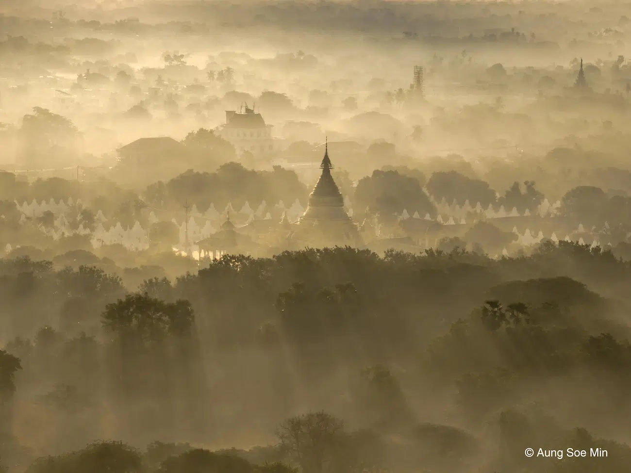
“A Winter Morning” by Aung Soe Min
Myanmar experiences a cool, dry season during the winter months, with daytime highs of almost 30°C and nighttime lows of 15°C, with virtually no rain. The mist may have formed as the ground cooled overnight. As the air close to the surface cools to its dew point, water vapor condenses into tiny, suspended droplets, creating mist. As the sun rises, its light passes through these droplets, scattering and softening the light, producing the soft glow seen here.
The annual competition celebrates photographs that show weather in all of its beauty, power, and unpredictability.
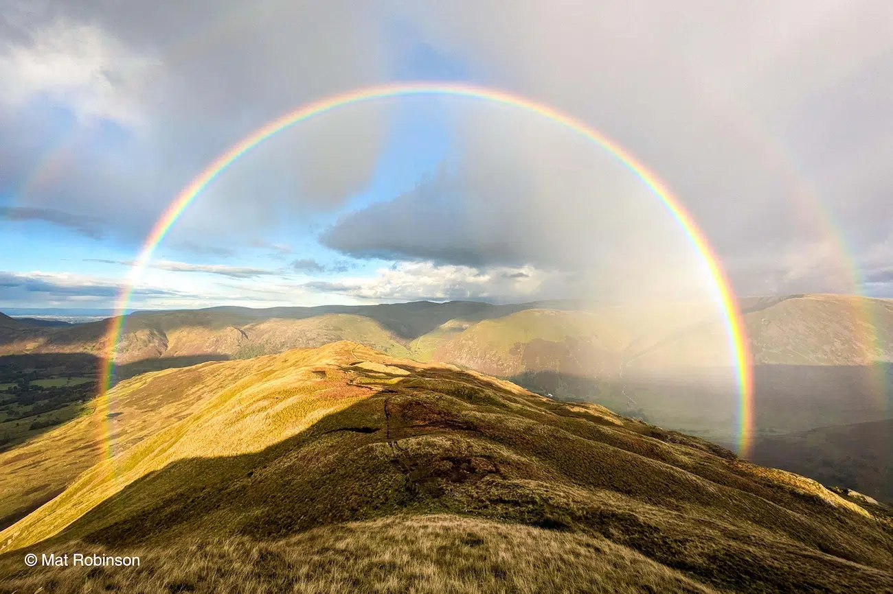
“Lakeland Rainbow” by Mat Robinson
After a long walk in the Lake District, England, Mat Robinson spotted distant rain falling over the Pennines, while dark clouds drifted overhead. Sensing the changing weather, he turned to his partner and announced that “something good’s about to happen.” His prediction paid off, with the perfect conditions producing a spectacular double rainbow.
Rainbows form when sunlight enters raindrops, bends as it refracts, and reflects off the inside of each droplet before emerging again. In a primary rainbow, the light undergoes one internal reflection. A secondary rainbow forms when light reflects twice inside the droplet, creating a second, larger arc outside the first.
That extra reflection makes the secondary rainbow fainter, as more of the light is lost along the way. It also reverses the order of the colors.
You may notice a darker band of sky between the two arcs, known as Alexander’s band. The primary rainbow appears at an angle of roughly 40-42 degrees from the point directly opposite the sun, while the secondary rainbow appears at around 50-53 degrees. The sky between the two rainbows appears darker because the raindrops cannot scatter light into this area, meaning less light reaches the eyes of the observer.
Mat’s patience and instinct for the weather paid off, capturing two colorful rainbows that frame the fells.
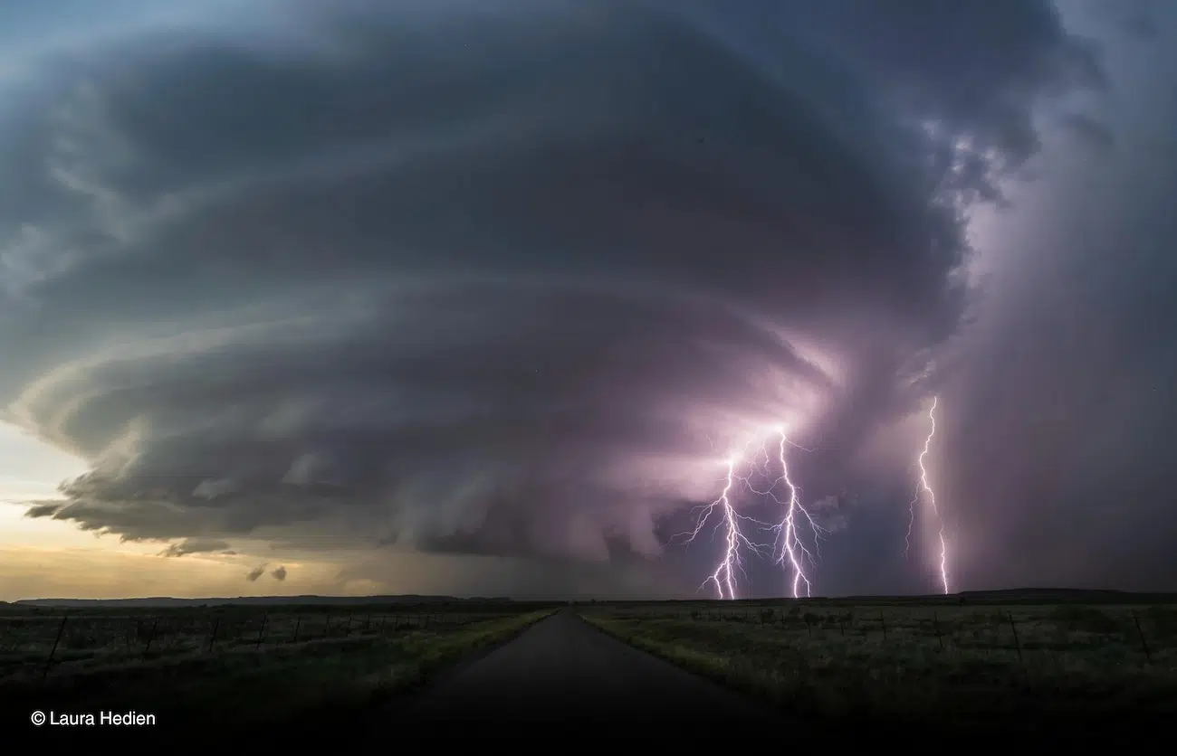
“An Oklahoma Light Show” by Laura Heiden
While out storm chasing, Laura Hedien was able to capture this terrifying shot. Stretching across the horizon, a vast, swirling supercell dominates the Great Plains of Oklahoma, USA. Beneath it, a long road leads towards the storm, while the last light of the day sets.
Oklahoma lies within the Great Plains, a region of the central United States known for its extreme weather. During late spring and early summer, warm, moist air flowing north from the Gulf of Mexico can meet cooler, drier air moving south from Canada or east from the Rocky Mountains. This collision of contrasting air masses creates the ideal conditions for atmospheric instability, fuelling severe thunderstorms, large hail, and tornadoes across the region. When these storms form in areas of strong vertical wind shear, they can develop into supercells.
Unlike ordinary thunderstorms, supercells contain a persistent rotating updraft, known as a mesocyclone, which helps organize and sustain the storm.
As daylight fades, lightning briefly illuminates the storm, revealing its immense scale and intricate structure. The contrast on either side of the road, with the peaceful yellow sunlight and the violent lightning strikes and dark cloud perfectly captures both the beauty and the power of supercells in the Great Plains.
“Midnight Sunbeam over Reine,” by Vit Javorik
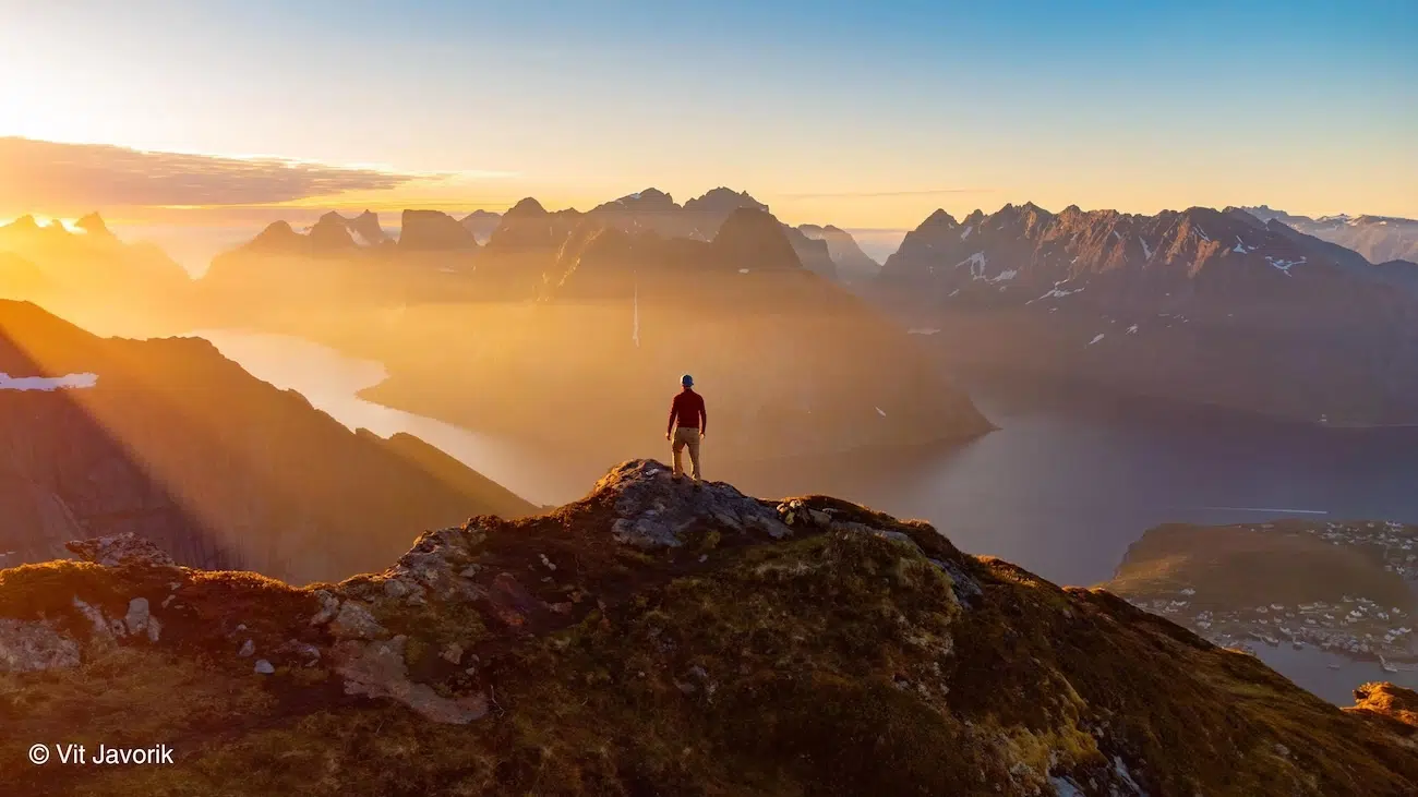
High above the fjords of Reine in Norway’s Lofoten archipelago, sunlight pours between the jagged mountain peaks and into the fjord basin below. But what you might not expect is that this photo was actually taken at midnight. During the Arctic summer, the Sun can remain above the horizon around the clock, bathing the landscape in a golden glow long after most of the world has fallen dark. This phenomenon is known as the midnight sun. North of the Arctic Circle, the Earth tilts towards the Sun during summer, meaning the Sun does not dip below the horizon for days, weeks, or even months at a time, depending on the latitude. Rather than the familiar cycle of sunrise, sunset, and darkness, the region experiences an extended period of daylight, with the Sun tracing a low path across the sky. For this photo, Vit Javorik “flew a drone and posed for the shot”. He “climbed the Reinebringen twice in the day, yet waited until midnight for the right conditions, but it was all worth it for this shot.” Vit’s presence in the frame offers a sense of scale, showing just how small we are against the vastness of the natural world.
The full shortlist is available online, with public voting open through November 5, 2026.
“Mares de niebla” by Francisco Bailón Rodríguez
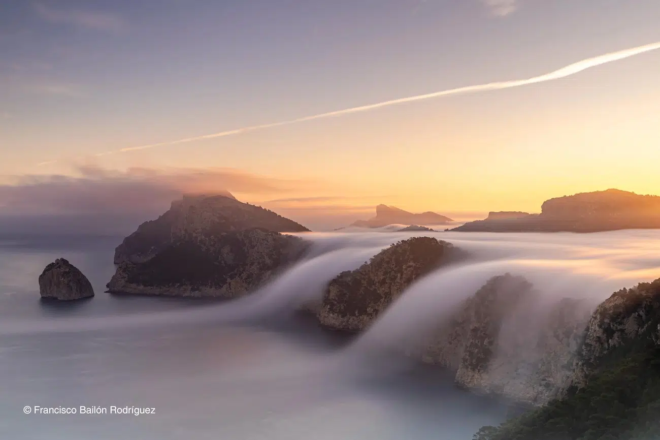
Taken from the Albercutz Watchtower in Mallorca, Spain, looking towards the Formentor Peninsula, this stunning image captures the first light of dawn illuminating the fog below. As Francisco Bailon Rodriguez recalls, “it was sunrise and we had experienced several days of anticyclonic weather and nights with high humidity.”
Those conditions were ideal for creating the large areas of fog and low cloud that blanketed the landscape. Under persistent high pressure, air slowly sinks and warms as it descends, often creating a temperature inversion. This is when warmer air sits above cooler air near the surface, acting like a lid and limiting the amount of vertical mixing. With light winds, high humidity and clear skies, the ground loses heat through radiation overnight, cooling the air above it to its dew point. Water vapor then condenses into tiny water droplets, forming fog.
The rugged terrain helped shape this scene. A southwesterly wind pushed the low cloud towards the steep cliffs, where the cooler, denser air could only flow downhill under gravity. As the fog spills over the ridges, it creates the appearance of a waterfall flowing into the sea below.
“Wildfire haze in New York City,” by Brendan Chan
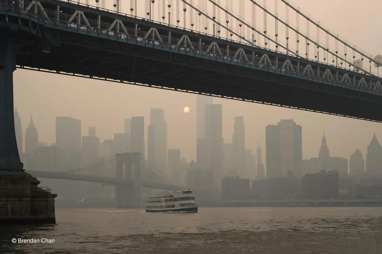
At first glance, the sepia-colored haze in this photo could make New York City, USA, look as though it belongs to another era. In fact, Brendan Chan captured this image in July 2026, when smoke from intense wildfires burning across Canada traveled hundreds of miles, casting an eerie brown tint over the city’s famous skyline.
“You could smell it, see it and feel it with the heaviness it came,” says Brendan, describing how the smoke transformed the air around him.
Wildfire smoke can travel vast distances, carried by winds and transported through the atmosphere. Large-scale weather patterns, including the position of the jet stream, can influence the movement of air masses and help determine where smoke travels.
There is also a growing connection to human-caused climate change driving the increasing severity of extreme Canadian fire seasons. Hotter conditions can contribute to the extreme fire weather that allows fires to spread rapidly and burn over larger areas, increasing the amount of smoke released into the atmosphere.
The smoke itself contains a complex mixture of gases and tiny airborne particles. Of particular concern is fine particulate matter, known as PM2.5, which is small enough to penetrate deep into the lungs. Exposure to high concentrations can irritate the eyes and airways, cause breathing difficulties, and worsen existing respiratory and cardiovascular conditions.
Brendan’s photo perfectly captures how wildfire smoke is not just a local problem, but one that can cross borders, affect public health, and transform the appearance of an entire city.
“Exposed,” by Graham Niven
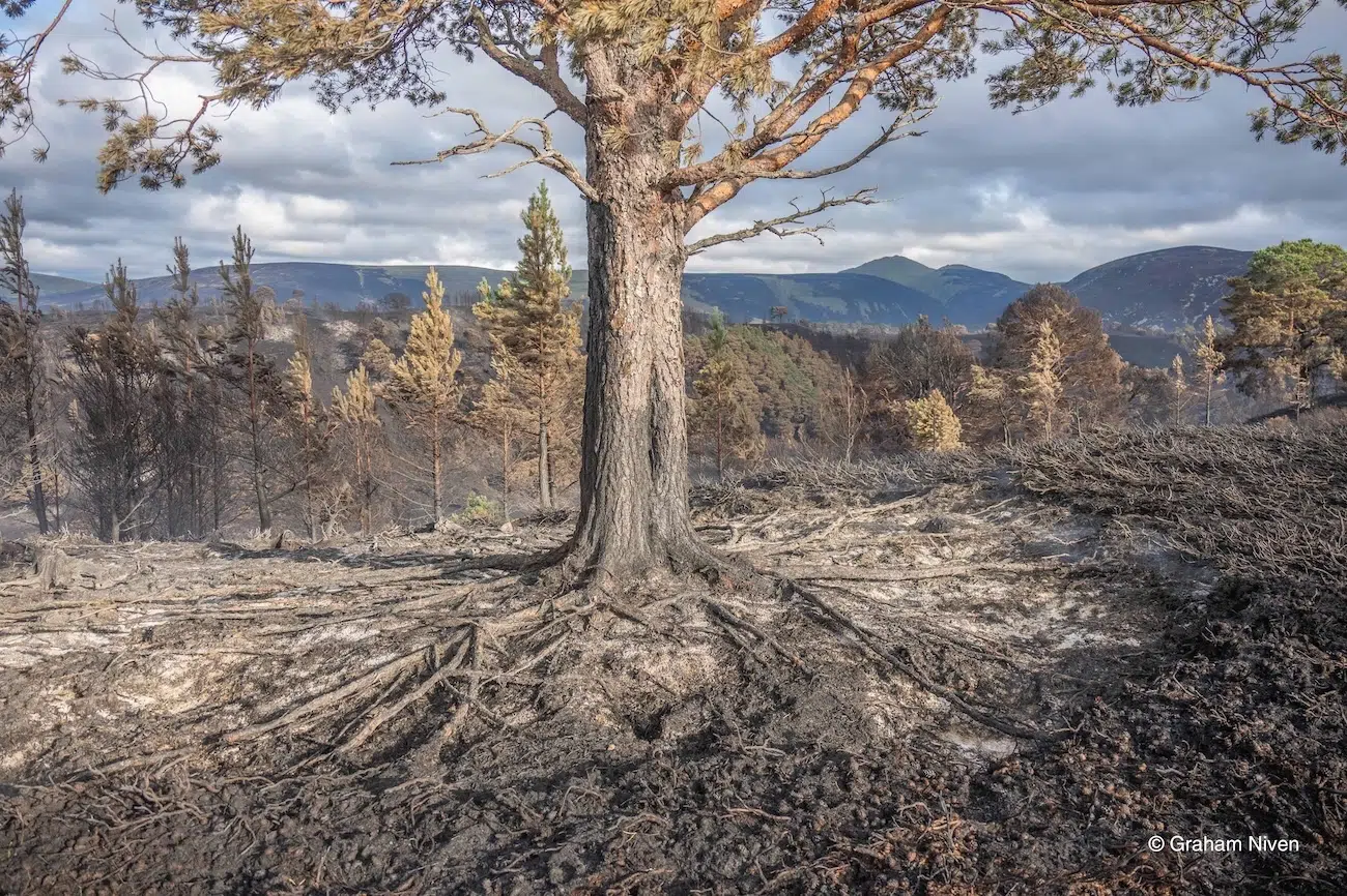
The Cairngorms, Scotland, the UK’s largest national park, are known for their ancient Caledonian pinewoods, vast peatlands and wildlife-rich landscapes. But in July 2026, wildfires tore through parts of the park, leaving precious habitats devastated. Among the losses were centuries-old Scots pines, some of which had stood for generations before their roots became exposed and surrounding peat were consumed by fire.
For Graham Niven, this was not simply a disaster to witness from afar. He joined a team of volunteers working to tackle the fire, digging into the burning peat and soaking hotspots to prevent the flames from spreading again.
Peatlands are particularly vulnerable to wildfires. Formed over thousands of years, layers of partially decomposed plant material accumulate in waterlogged conditions, storing vast quantities of carbon. When prolonged dry weather conditions cause the surface to dry out, fires can burn deep into the ground, smoldering beneath the surface, even when the visible flames have disappeared.
Once burned, these ecosystems can take decades or longer to recover, and deep peat fires can release carbon that has accumulated over millennia.
Scotland’s wildfire risk is expected to increase as the climate changes. Towards the end of the century, projections indicate that summers are likely to become drier, while extreme heat and drought become more frequent. The Met Office identifies wildfire as an ‘emergent risk’ for the UK, with future projections pointing towards an increase in hazardous fire-weather conditions.
But Graham’s experience reveals the human effort required to protect their landscapes.
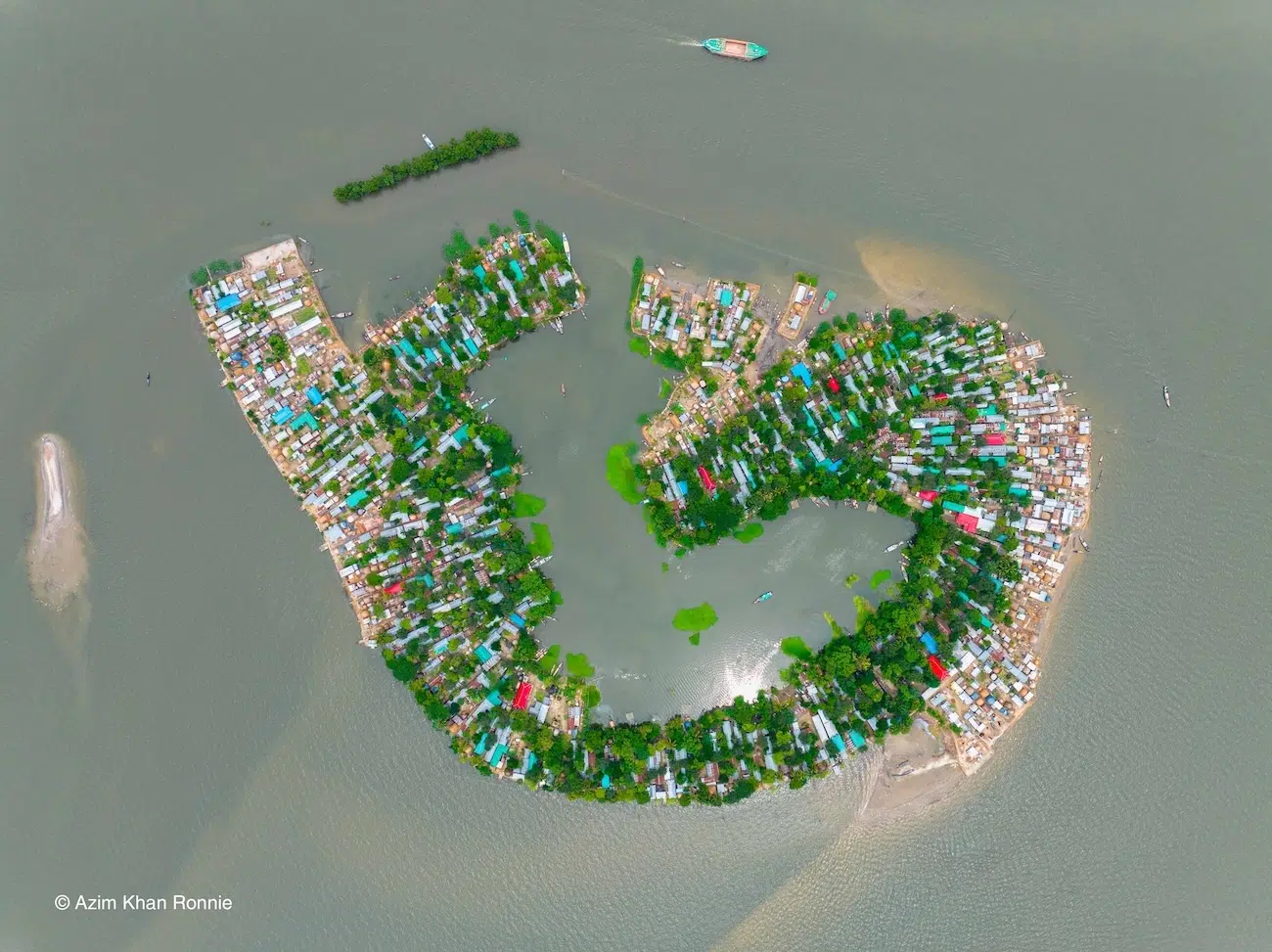
“Life on the Flooded Edge,” by Azim Khan Ronnie
From above, a densely inhabited community in Kishoreganj, Bangladesh, appears almost like an island, with its colorful rooftops and greenery contrasting the surrounding water. This is not an island, but a community in the wetlands, where flooding is a familiar part of life which has increasingly been putting homes and livelihoods at risk.
For generations, people living in these low-lying regions have adapted to the seasonal rise and fall of the water. When floodwaters retreat, the exposed land provides rich grazing for cattle, while farmers grow rice during the dry season. As the water returns, the wetlands become important breeding grounds for fish. To protect their homes from seasonal flooding, families build them on raised mounds.
However, intense rainfall can trigger flash floods before the monsoon season, submerging rice fields before crops can be harvested and damaging fish stocks. Climate change is increasing the risk of heavy downpours as a warmer atmosphere holds more moisture, while deforestation in the region can increase surface runoff and erosion, potentially worsening flooding.
Azim explains how even in “this vast expanse of water, people continue to live, work and adapt. The image reveals the human impact of extreme weather: when water rises, it does not simply change the landscape, it changes how people move, live and survive.”
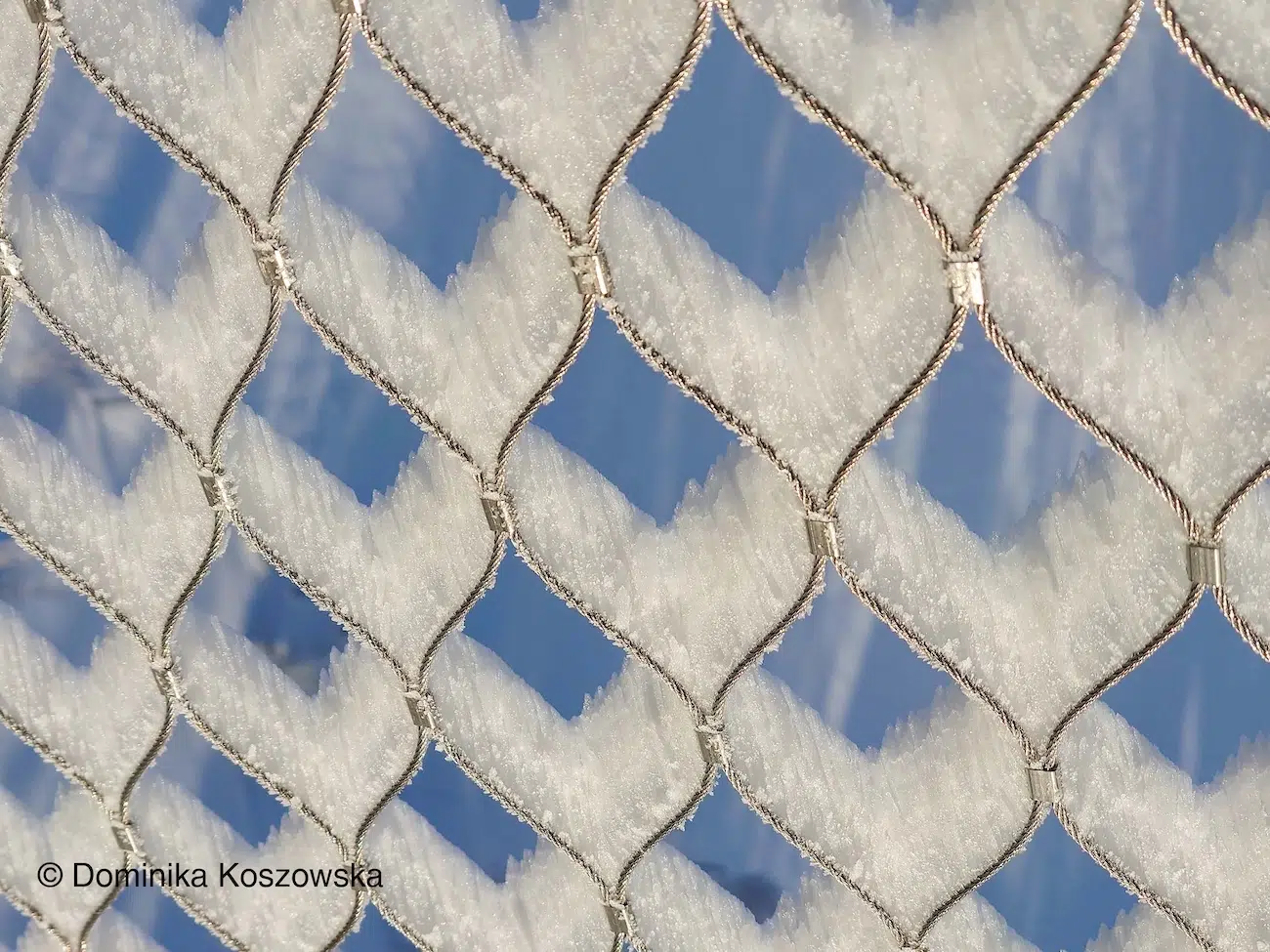
“Ice Hearts,” by Dominika Koszowska
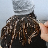
After witnessing a spectacular sunrise in Łapszanka, Poland, Dominika Koszowska’s winter adventure had another surprise in store. During a treetop walk in Bachledova dolina, Slovakia, at nearly 1,200 meters above sea level, she noticed a safety wire mesh that had been transformed by a thick coating of hard, white rime ice. Delicate, repeating patterns had formed across the metal, resembling rows of frozen hearts.
Rime ice is a winter phenomenon, turning everyday objects into intricate natural sculptures. Wind can drive supercooled water droplets into surfaces that are below freezing. On impact, the droplets freeze, gradually building up a coating of ice on the windward side. These conditions often occur in freezing fog, particularly at higher elevations where cloud droplets meet exposed surfaces.
The mesh in the image provided a ready-made frame for the ice to grow around, creating a repeating geometric pattern that made the frozen formations look almost deliberately arranged. Dominika was captivated and “instantly had to capture” the unusual sight.
“This dynamic process of atmospheric physics transformed an ordinary fence into a fragile, white art gallery”, she says. “The contrast between the geometric order of the crystals and the deep blue sky reveals the extraordinary power and subtlety of nature.”
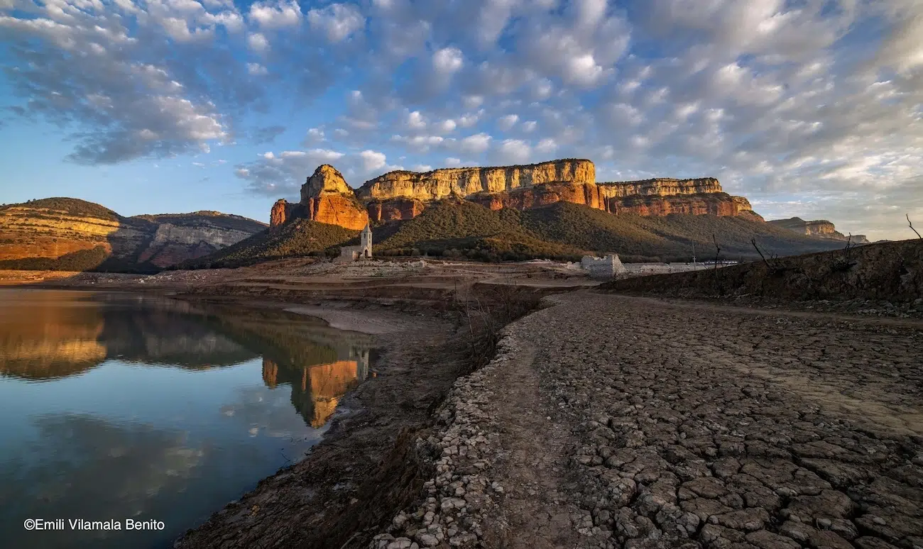
“Reflections with little water,” by Emili Vilamala Benito
Usually, only the tip of the bell tower of Sant Romà de Sau rises above the water in the Sau Reservoir, Catalonia, Spain. In this image, however, the reservoir had fallen so far that the entire church stood exposed.
The village of Sant Romà de Sau dates back to the tenth century and was intentionally flooded in 1962 to create the reservoir on the Ter River. The 23-meter-tall church was the only building left, becoming the oldest standing submerged church in the world.
In February 2024, when Emili Vilamala Benito captured this image, Catalonia was facing a prolonged and severe drought. The regional government declared a drought emergency, with water reserves in the Sau reservoir dropping to less than 6% of its capacity. “For the past two years, the Sau reservoir has maintained a very good water level”, explains Emili. “However, prior to these two years, the reservoir was almost empty. And for the last few years, it has typically been quite low.”
Droughts are more common in some parts of the world than others, but climate change is increasing the likelihood of hotter and drier conditions, particularly across the Mediterranean. The result is greater pressure on already limited water resources.
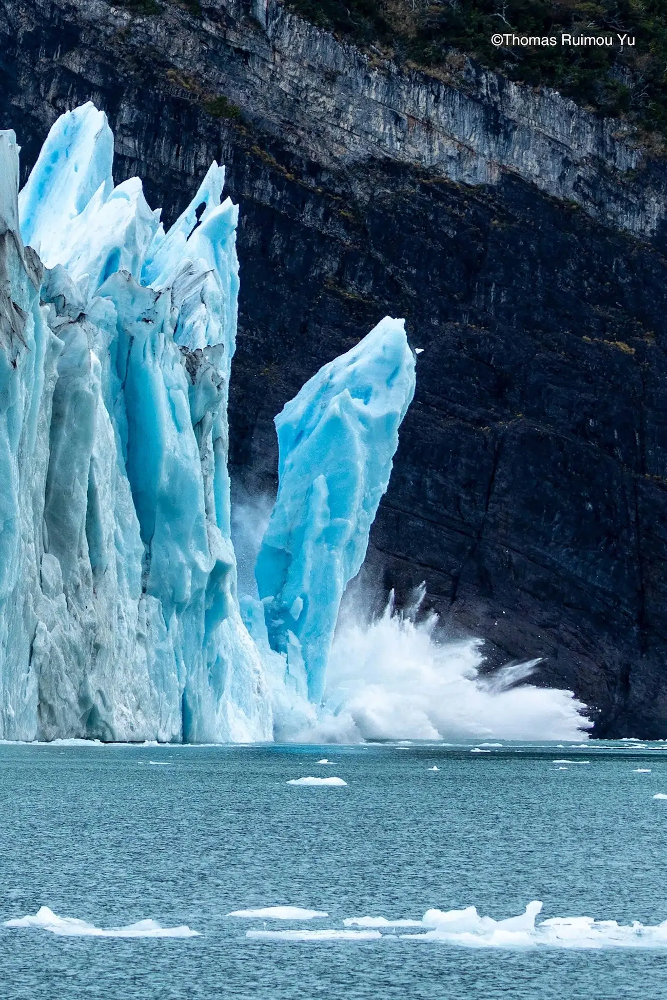
“Glacial Calving Surge,” by Thomas Ruimou Yu
The calving zone of the Perito Moreno Glacier in southern Patagonia, Argentina, is a dramatic 5-kilometer-wide and 70-meter-tall ice wall where massive chunks of blue ice routinely crash into Lago Argentino.
Glacial calving is the breaking of large chunks of ice from the edge of a glacier. As glaciers flow, driven by their own immense weight and the pull of gravity, stresses build up within the ice. When these stresses exceed the ice’s strength, it fractures, sending pieces tumbling into the water below. While calving is a natural part of a glacier’s life cycle, its frequency and magnitude are closely monitored by scientists.
The Perito Moreno Glacier is experiencing accelerated ice loss, thinning, and rapid retreat in its calving zone due to rising regional temperatures and reduced snowfall. Between 2019 and 2024, some parts of the glacier’s northern front have retreated by as much as 800 meters.
The changes are consistent with broader patterns of glacier response to climate change. Rising air temperatures, altered precipitation patterns, and warmer water at the glacier’s end all contribute to increased melt and structural changes.
After eight years, Thomas Ruimou Yu revisited the Perito Moreno Glacier in 2026. Reflecting on the changes he observed, “the scene looked drastically different, with far more floating ice and frequent calving events”.
“Sunset Supercell” by William Huxley Eades
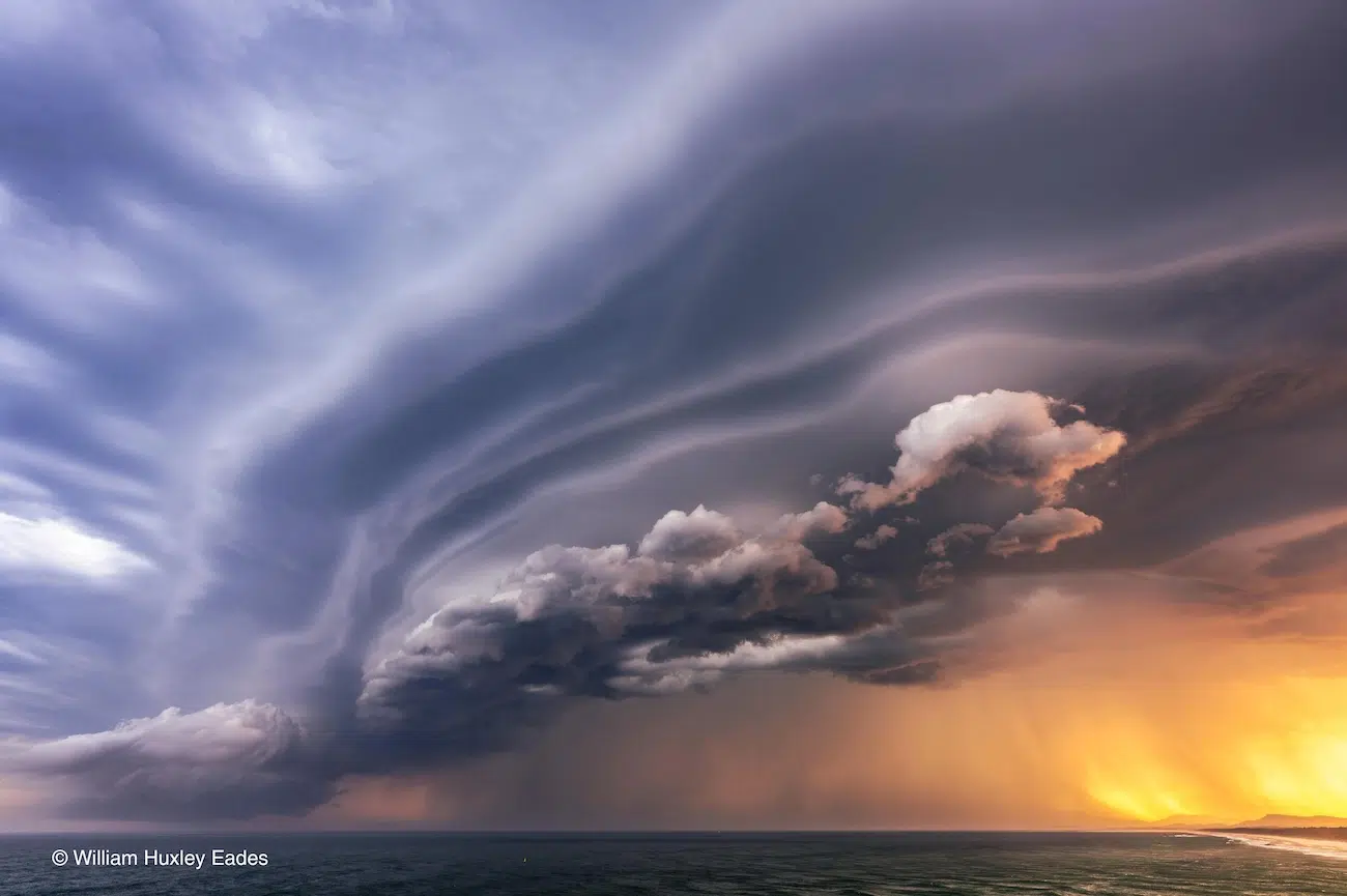
As sunset approached over Port Macquarie, New South Wales, Australia, a towering supercell engulfed the sky, with “its sculpted cloud structure stretching across the sky as the rain core glows in golden light”, says William Huxley Eades. The dramatic contrast between the storm’s dark, layered clouds and the warm colors of the setting sun makes this a striking capture of one of the atmosphere’s most powerful displays.
“I had been tracking the supercell as it moved towards Australia’s east coast”, explains William. “This storm approached from the west, and as it drew nearer, we could see its radar signature grow into a huge system”.
Supercells are a type of thunderstorm distinguished by a persistent rotating updraft, which is a rising column of air that helps the storm maintain its organization for much longer than many ordinary thunderstorms. They can produce severe weather, including intense rainfall, damaging winds, large hail, and sometime tornadoes. Their powerful, organized airflows can also create striking cloud formations, with curved bands and layered structures, as seen in this image.
“Triple strike NYC,” by Dan Martland
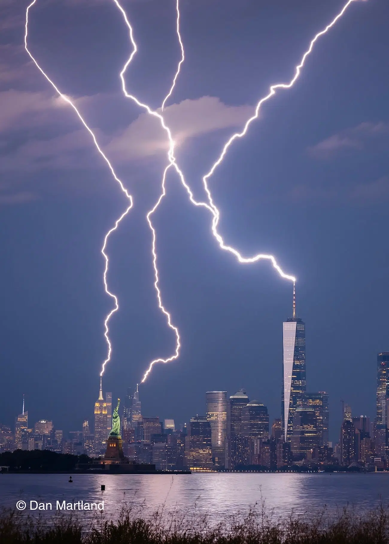
Talk about being in the right place at the right time. From Bayonne, New Jersey, USA, Dan Martland captured this spectacular scene overlooking the New York City skyline, as three lightning strikes lit the sky above the city.
“I was watching the cells build using RadarScope and I actually thought it was going to miss New York City on this occasion,” explains Dan. “But this bolt came out of nowhere. My trusty lighting trigger managed to fire my camera which was framed up and pointing in the right direction.”
August in New York is typically hot and humid, providing the ingredients for powerful thunderstorms. Warm, moist air rises, cools, and condenses to form towering cumulonimbus clouds. Inside these clouds, strong updrafts and downdrafts occur in close proximity. Updrafts transport water droplets high into the atmosphere, meanwhile downdrafts transport hail and ice towards the surface. When these collide, electrical charges build up and separate. When the difference in charge becomes large enough, the atmosphere releases that energy in a spectacular flash of lightning.
Cloud-to-ground lightning, like the ones captured here, develop through a rapid sequence of electrical events. An invisible channel of negative charge, known as a stepped leader, zigzags downwards from the cloud. As it approaches the ground, upward-reaching channels of positive charge, called streamers, can rise from the highest objects in the area. When the channels connect, a powerful electrical current surges through the path, traveling at about 60,000 miles per second, producing the brilliant flashes we see.