“Sprites Dancing in the Dark Night” by Wang Xin (China). Location: Chongming District, Shanghai, China. Winner, Standard Chartered Weather Photographer of the Year 2024
“As multiple thunderstorms raged around Shanghai, Xin traveled to the Chongming District and adopted a trial-and-error approach by setting up the camera and waiting. After a few hours, a “faint red figure” flashed in Xin’s eyes, and this remarkable image was captured. The elusive sprites only last a few milliseconds, so Xin used a four-second exposure to achieve this photo.
Sprites occur due to electrical discharge, but unlike ordinary lightning, they occur well above cumulonimbus clouds, approximately 50 miles (80km) above the ground, in a layer of the atmosphere known as the mesosphere. Due to their fleeting nature, sprites are still not well understood, but they have been observed to occur after a strong, positive lightning bolt between the cloud and ground. The red color comes from changes in the energy of the electrons of nitrogen atoms high in the atmosphere.”
A photo of rare red sprites in Shanghai won the Royal Meteorological Society's Standard Chartered Weather Photographer of the Year competition. Selected from a shortlist of 25 photos, the image required photographer Wang Xin to spend hours on site and wait for the moment when the elusive sprites appeared.
These fairy-like sprites only last a few milliseconds, so to capture them effectively, Xin used a four-second exposure. The expert judging panel, recognizing how difficult it is to see and photograph red sprites, was impressed by the sheer number of sprites in the image. Noting that they only occur in 1 out of 200 lightning strikes, they were also struck by his patience and tenacity in getting the image that he was after.
In addition to the overall winner, the competition also singled out individuals in Smartphone and Youth categories. And for the first time, the contest handed out a special Climate Award. That inaugural award was won by Brazilian photographer Gerson Turelly for his striking shot of a young man kayaking through floodwaters in Porto Alegre to help rescue stranded people.
Turelly's image also captured the public's imagination, as it was also named Public Favorite after winning an online vote. The judges were not only impressed by the aesthetic and technical aspects of the photo, but also the way it displays a “powerful combination of weather and climate impacts.”
Extreme weather is an overarching theme in this year's winners, with many photos showing the dramatic effect of climate change.
“I’m delighted with the variety and quality of this year’s winning photographs, which show a real window into the world’s weather and climate, in both its regional differences and its interconnectivity,” shares Professor Liz Bentley, chief executive of the Royal Meteorological Society. “From African dust impacting on Athens to tranquil weather over volcanoes, from a sudden local downpour to increased intense rainfall and flooding around the world, we are reminded that climate change is impacting on weather patterns everywhere and that the global community needs to come together to act now and curb any further temperature rise.”
Scroll down to see more of the winners, and then head over to the winner's gallery to see all the finalists.
Here are the incredible winners of the 2024 Standard Chartered Weather Photographer of the Year.
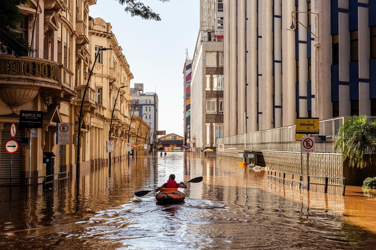
“Rowing” by Gerson Turelly (Brazil). Location: Porto Alegre, Rio Grande do Sul, Brazil. Winner, Standard Chartered Climate Award 2024 and Winner, Public Favorite
“Captured by local photographer Gerson Turelly, this image shows the center of Porto Alegre, Brazil, during the devastating Rio Grande do Sul floods in Spring 2024. In this image, a road has turned into a waterway down which a young man paddles his kayak. Gerson notes that the kayaker was headed towards the worst affected areas to help rescue stranded people.
The composition and lighting of the photo were praised by the judging panel, as well as the powerful combination of weather and climate impacts portrayed in the scene. Judges commented how the picture shows “past, present and future”; flooding has always been something that we must deal with and adapt to, however as climate change increases the intensity of heavy rainfall, flooding will become even more common.
Looking at the most intense ten-day period during this event, World Weather Attribution showed that climate change made the flooding at least twice as likely, and six to nine percent more intense. The El Niño Southern Oscillation was also shown to play a large role in increasing the likelihood and intensity of this event, demonstrating how natural variability of the ocean and atmosphere can combine with climate change to produce particularly extreme events.”
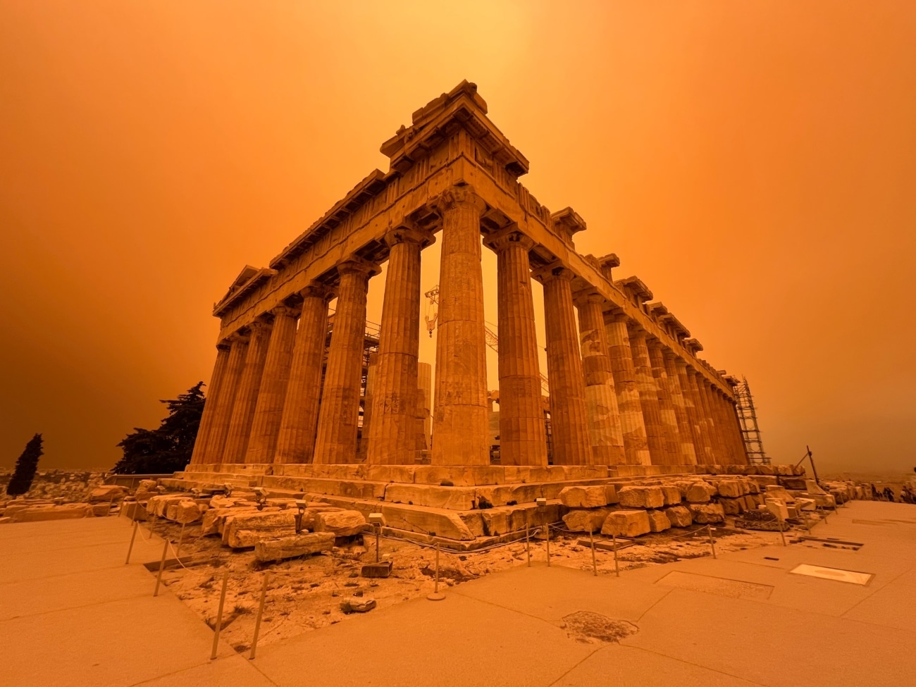
“You might be forgiven for thinking that the Parthenon has been magically transported to Mars, but this scene is actually much more down to Earth! This image shows the influence of Saharan dust on Athens during April 2023 and is a reminder of the interconnectivity of weather conditions around the world, an aspect that particularly impressed the judges.
An area of low pressure over Libya created strong southerly winds that transported the dust from northern Africa to Greece. Hot air from the Sahara also surged northwards, with the high temperatures adding to the unpleasant environment. People with respiratory health conditions were warned to limit outdoor activity and avoid physical exercise. The warm southerly winds also contributed to a much earlier start to the fire season in southern Greece, adding to the health risks.
Although the April Saharan dust outbreak was particularly severe, there had been several other outbreaks across southern Europe in the preceding months. Looking at trends over the past few decades, there is evidence that the number, intensity and length of these outbreaks are increasing. Temperature increases in the Mediterranean and persistent drought in northwest Africa are among the reasons for an increase in dust outbreaks.”
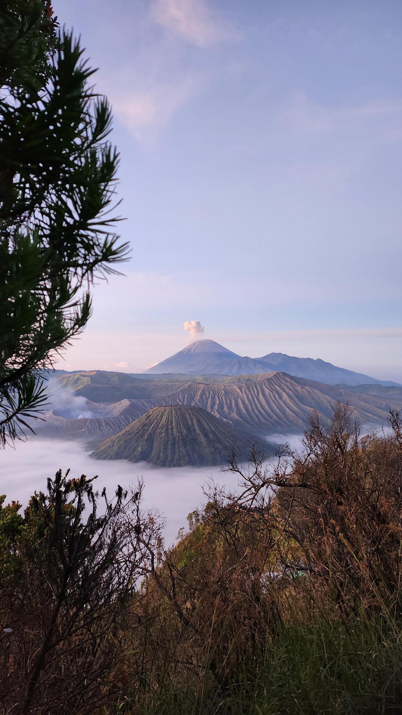
“Volcanoes” by Nur Syaireen Natasya Binti Azaharin (Malaysia). Location: Bromo, Indonesia. Winner, Standard Chartered Smartphone Weather Photographer of the Year 2024
“Photographer Nur Syaireen Natasya Binti Azaharin had gone out with the expectation of capturing a sunrise but was instead rewarded with this glorious view of smoking volcanoes in East Java, Indonesia. Sitting above the low-level stratus clouds, she was afforded a tranquil view of the peaks in the early morning light and snapped the scene with her Samsung Galaxy Z Flip4.
A small pyrocumulus cloud (also known as flammagenitus) sits atop Mount Semeru (central peak in the background) and small plumes of smoke and steam are emitted from the crater of Mount Bromo (front left). Pyrocumulus clouds not only form above volcanoes, but above heat sources such as forest fires and power station cooling towers which cause air to rise. Moisture in the air will condense to form a cloud once the air has risen to a cool enough altitude.
Volcanoes emit small particles into the air which provide additional surfaces onto which the water vapor can condense. Therefore, pyrocumulus clouds can appear more dense than other clouds, being formed of many small droplets. If the heat source is large enough, deep rising currents of air may form, allowing the pyrocumulus to evolve into a pyrocumulonimbus which, like a cumulonimbus cloud, may be associated with thunder and lightning.”
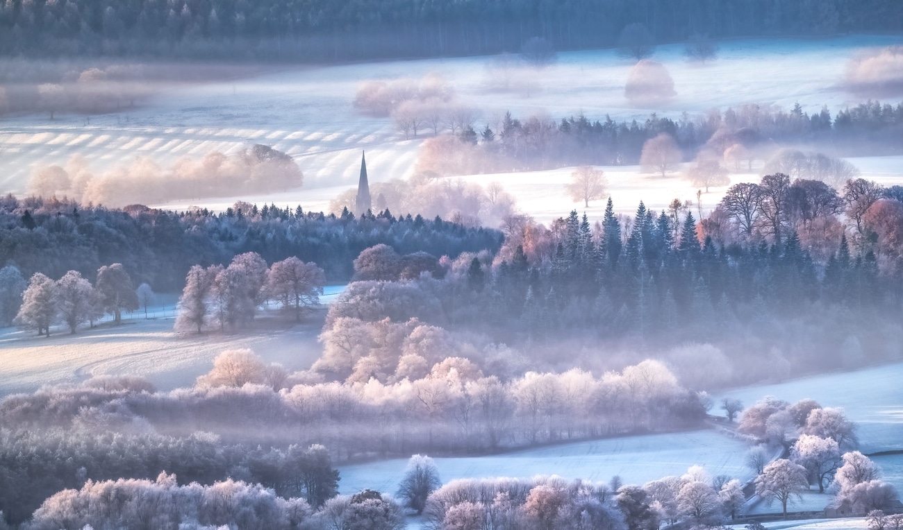
“Hoarfrost Heaven” by Andy Gray (UK). Location: Peak District, England, UK. 2nd Place.
“ Photographer Andy Gray was especially pleased to have captured this image as he feels hoar frost has become rarer in the Peak District. In Old English, the word ‘hoar’ is related to old-age, and so this frost gets its name from its resemblance to white hair. Hoar frost differs from ground frost because it occurs when the surface is already below freezing. The water vapor immediately freezes on contact with the object rather than first condensing as liquid water and then freezing.
The image was taken during a period of high pressure which led to particularly cold weather. Within high pressure systems (or anticyclones), air is generally sinking which leads to cloudless skies. At night, the lack of clouds means that more heat is lost to space, rather than being reflected back to the Earth’s surface. Winter nights can become very cold, encouraging the formation of frost and mist which can last well after the sun has risen.”
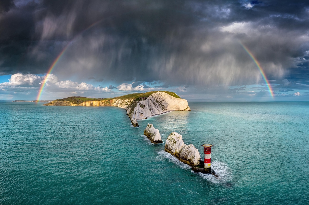
“Evening Shower Over the Needles” by Jamie Russell (UK). Location: The Needles, Isle of Wight, UK. 3rd Place.
“Some large showers started developing 20 miles or so to our north-northwest. Realizing they could cross The Needles with rainbow potential, we jumped in our rib at Colwell Bay and positioned ourselves with the camera. However, the composition was awkward, and the choppy sea was a challenge, so I sent up the drone, knowing the view would likely be a lot more impressive.
Although rainbows are a common optical phenomenon, the correct ingredients need to come together to see one. Firstly, the sun must be behind you, and it must be low in the sky. Secondly, an array of airborne water droplets must be ahead of you. When light travels through a water droplet, it slows down and changes direction because a water droplet is denser than air—this is known as refraction. The amount that light is refracted depends on its colour, which is why sunlight (consisting of a mix of all colors) is split into the rainbow spectrum when it is refracted. This spreading of the light into the different colors is called dispersion. When the light reaches the back of the water droplet, it is reflected and passes back through the droplet, again being refracted and further dispersed as it leaves the droplet.”
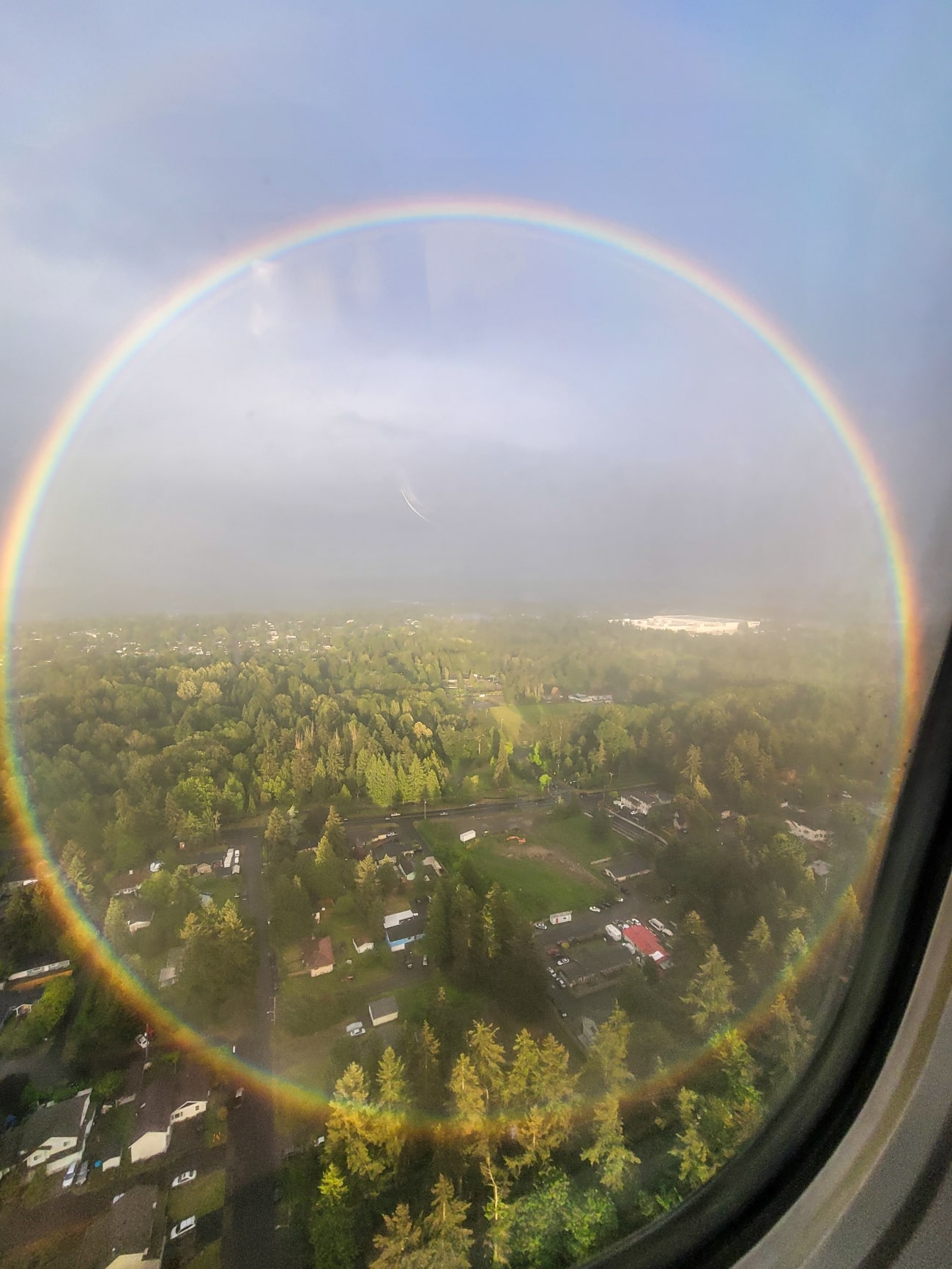
“Circular Rainbow” by Peter Reinold (USA). Location: Seattle-Tacoma International Airport, USA. 3rd Place, Smartphone.
“Photographer Peter Reinold held his camera phone steady through a turbulent landing at Seattle-Tacoma International Airport to capture this complete circular rainbow: “I always pick the window seat on planes, as you never know what you [might] encounter. It paid off this time.”
A rainbow’s shape is actually a circle centered on the point directly opposite the sun from you, but most of the time, we can’t see the full circle because the ground gets in the way. If you can get to a higher vantage point with water droplets below, you are more likely to see the complete rainbow. While a plane is an obvious location, sometimes you can also see circular rainbows from the top of tall buildings.”

“Saturated Earth and Sky’s Promise” by Ellis Skelton (UK). Location: Cuckmere Valley, East Sussex. 2nd Place, Young Weather Photographer.
“Young photographer Ellis Skelton eloquently describes his panoramic image of Cuckmere Valley in East Sussex: “The expansive horizon of the river Cuckmere spans across the picturesque landscape and the harmonious blend of earth and sky merge capturing natural tranquility and wonder within the landscape. Captured from above, this breath-taking panorama shows how powerful the weather can be”.
The judging panel noted how the photograph seems to contain two seasons: summer on the left and autumn on the right. The beauty of the sky contrasted with the flooding on the ground is a reminder of both the wonder and misery the sky can bring.
Sea levels are predicted to rise along the Sussex coastline, potentially by over 1 m by the end of this century. And as the Cuckmere River flows into the English Channel, those sea-level rises increase the likelihood of flooding in the Cuckmere Valley. The flood risk increases further thanks to changing river management techniques over the course of several centuries which have led to a build-up of shingle at the river mouth. There are fears that flooding could become the norm even sooner, as a Coastal Risk Screening Tool by Climate Central suggests that the annual flood level will cover most of the Cuckmere Valley by 2030.”
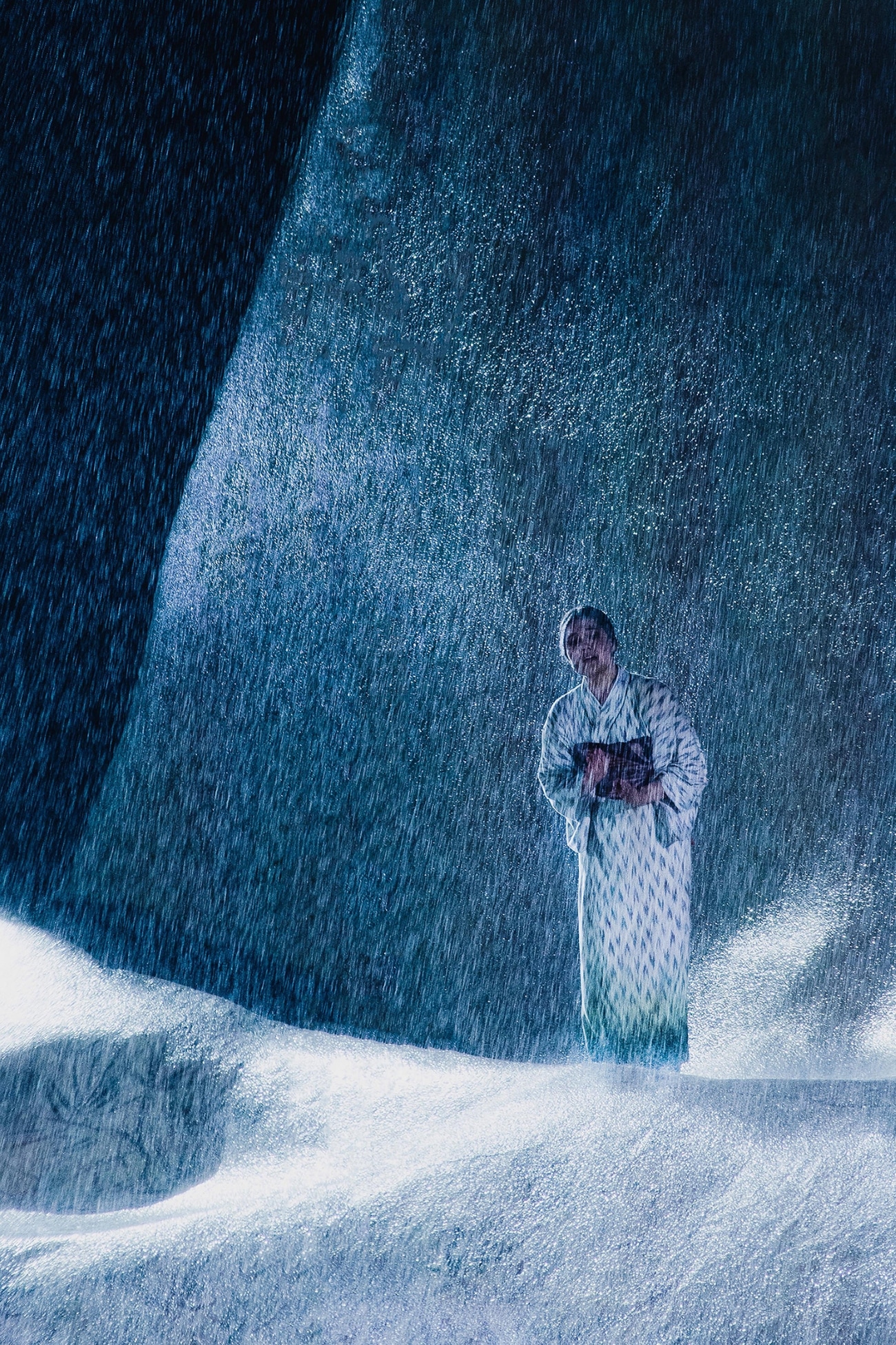
“Rain Aria” by Angelina Widmann (Austria). Location: Bregenz, Austria. Winner, Standard Chartered Young Weather Photographer of the Year 2024.
“Young photographer Angelina Widmann captured this stunning shot during an open-air performance of Madame Butterfly on the eastern shore of Bodensee (also known as Lake Constance) in Bregenz, Austria. Angelina noted how the “the rain made the plot even more dramatic”. This photo was taken with a telephoto lens due to the distance between Angelina and the stage. She used a short exposure to capture the falling drops, before sprinting to safety to avoid damaging her camera!
Bregenz is one of the wettest spots around Bodensee, due to its proximity to the mountains, receiving over 1600mm of rainfall per year. Perhaps this explains why the opera singers bravely continued their performances, even as the audience fled the arena in the sudden downpour! In the summer, monthly rainfall amounts can reach 200mm in Bregenz, most likely associated with summertime convection enhanced by moist air from the lake being lifted by the mountainous terrain.
As the atmosphere warms due to greenhouse gas emissions, the amount of water vapor in the air also increases. Additional water vapour means that when it rains, it pours. A change to more intense rainfall has already been observed in Europe and across the world. Although infrequent, such downpours can disrupt leisure activities, as well as transport, infrastructure and industry, so accurate forecasting of extreme rainfall will become increasingly important as our climate changes.”
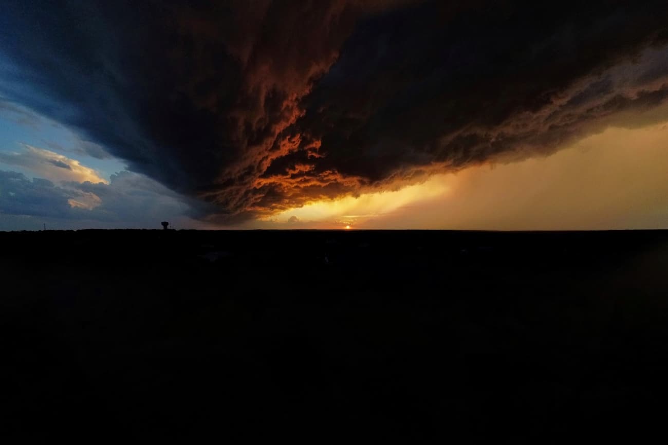
“Fire and Ice” by Lincoln Wheelwright (USA). Location: Austin, Texas. 3rd Place, Young Weather Photographer.
“As a thunderstorm began rolling in, young photographer Lincoln Wheelright grabbed his camera and took this picture from his house in Austin, Texas. The judging panel were particularly impressed with the split colors: the blue to the left of the cloud and the orange to the right. Lincoln explains how “the clouds were low enough that they blocked the light on the other side. This gave the effect of the fiery sunset versus the cold sky.”
Thunderstorms frequently strike late afternoon or early evening, as it tends to be the warmest and most humid time of day. Warm and moist air at the surface creates an unstable atmosphere, forming a deep cumulonimbus or thundercloud once air starts to rise. In some cases, the atmosphere becomes so unstable that the air rises without an outside trigger, but sometimes air lifted over a mountain or over a cooler, denser air mass triggers the storm.
Texas has an abundant supply of warm, moist air, thanks to the warm waters of the Gulf of Mexico to the south. The Gulf of Mexico is warming rapidly due to climate change, boosting the supply of moist air and raising the potential of intense storms in the region.”


